


Yongsheng County Climate
1.Geography
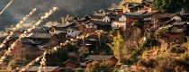
Yongsheng County covers two geomorphic units of the Hengduan mountain range and the northwestern Yunnan plateau, belonging to the edge region of the three-river parallel. There are many geomorphic types such as river, lake, mountain plain, basin (ba zi) and river valley. The terrain is high in the northeast and low in the southwest. The mountain range within the territory is mostly in south and north line, with valley basin between in length of 110 kilometers and width of 5-20 kilometers, including Sanchuan dam, Xinghu dam, Qina dam, Taoyuan dam and Pianjiao dam, which account for 23.10% of Yongsheng county's total land area.
The highest point in Yongsheng county is peak Taerbuzi of Guangmao mountain, 3963.5 meters above sea level, and the lowest one is Xintian River near the Jinsha river, 1056 meters above sea level. The Jinsha river enters Yongsheng Coutny from Songping Township in the north and cover about 215 km in the territory.
2. Climate
Yongsheng County is located in the area of low latitude and high altitude, where the north subtropical mountain monsoon climate dominates. Due to the large elevation difference and complex landforms within the county, there are various types of three-dimensional climate. The general climate characteristics are: dry in spring and winter, rainy in summer and autumn, hot and dry in the south, warm and humid in the north. Annual temperature change is small and the time and space difference of precipitation is large. The annual total solar radiation quantity is 136.2 kcal/cm2 with good light quality, and sufficient light with 2403.6 hours of sunshine. The county seat is Yongbei Town, where the average temperature of 13.5 ℃, the lowest average monthly temperature of 6.1 ℃ and the hottest average monthly temperature of 19.0℃.
3. Best Time to Visit
Spring and Autumn are the best time to travel Yongsheng County.


