Diqing Geography
Diqing Tibetan Autonomous Prefecture is situated at the junction of Yunnan, Sichuan, and Tibet. It lies in the southern extension of the Qinghai-Tibet Plateau and is the highest-altitude area in Yunnan Province. The prefecture is located between 98°20′-100°19′ E longitude and 26°52′-29°16′ N latitude. To the east, it borders Muli Tibetan Autonomous County in Sichuan Province and Ninglang Yi Autonomous County in Lijiang City. The southern border includes Yulong Naxi Autonomous County in Lijiang City and Lanping Bai and Pumi Autonomous County and Fugong County in Nujiang Lisu Autonomous Prefecture. To the west, it is adjacent to Zuogong County and Zayü County in the Tibet Autonomous Region and Gongshan Dulong and Nu Autonomous County in Nujiang Prefecture. The northern border meets Mangkam County in the Tibet Autonomous Region and Batang, Derong, and Xiangcheng counties in Garze Tibetan Autonomous Prefecture, Sichuan Province. The maximum east-west width is 168.56 kilometers, and the maximum north-south length is 260.77 kilometers, with a total area of 23,185.67 square kilometers.
Topography and Landforms
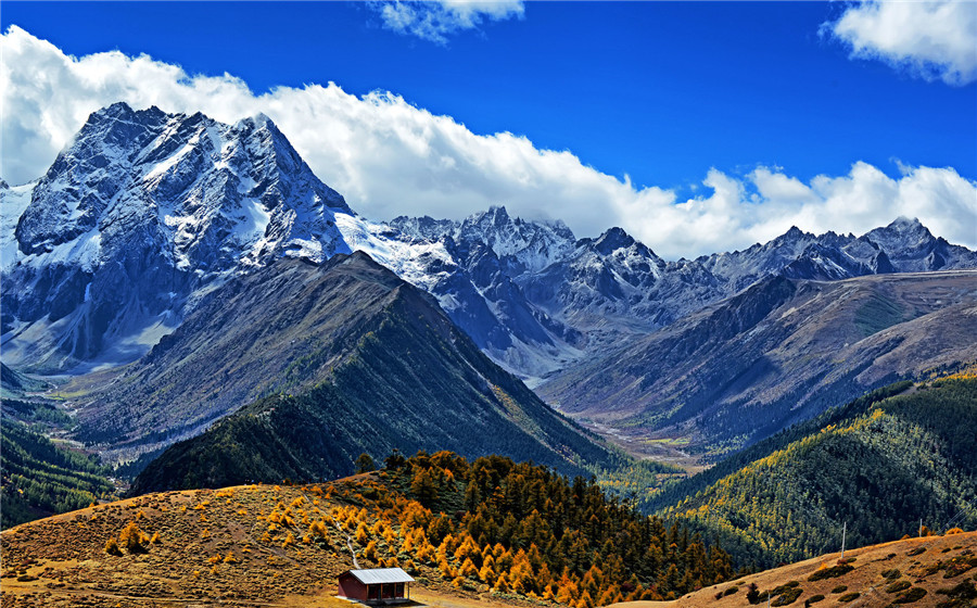
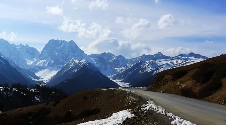
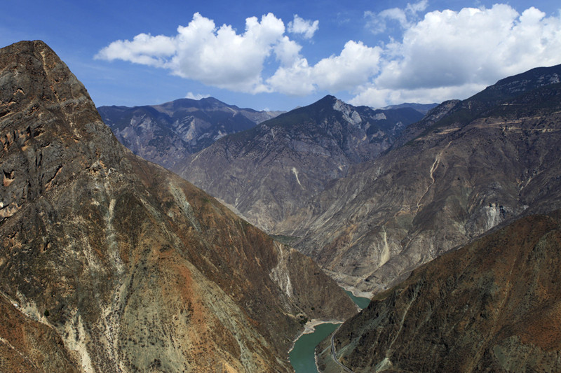
Diqing Tibetan Autonomous Prefecture has a butterfly-shaped terrain, with higher elevations in the north and lower in the south. The landscape is dominated by mountains, ancient plateau surfaces, and mountain peaks. The geography features “three mountains embracing two rivers.” The three mountains, from west to east, are the Meili Snow Mountain Range, Yunling Snow Mountain Range, and Shangri-La Snow Mountain Range, with the Lancang and Jinsha rivers flowing between them. The highest point in the prefecture is Kawagebo Peak of Meili Snow Mountain at 6,740 meters, while the lowest point is at the confluence of Biyu River and Lancang River in Weixi County, at an altitude of 1,486 meters. The varied terrain and climatic conditions create three vertically distributed ecological environments: alpine areas (2,800-6,740 meters), mountainous areas (2,200-2,800 meters), and river valley areas (1,486-2,200 meters).
Climate
Diqing Tibetan Autonomous Prefecture experiences a temperate and cold temperate monsoon climate, with the river valley areas having a northern subtropical monsoon climate. It features distinct low-latitude plateau monsoon characteristics, with clear wet and dry seasons. The annual average temperature ranges from 6.3°C to 11.8°C, with the hottest month averaging 13.6°C to 18.8°C and the coldest month averaging -2.3°C to 4.2°C. The extreme minimum temperature is -27.4°C. The prefecture receives 1,824.9 to 2,150.2 hours of sunlight annually, with precipitation ranging from 651.1 to 971.5 millimeters. The frost-free period lasts 127 to 201 days. About 85% of the annual precipitation occurs during the rainy season (May to October), mainly in July and August. The dry season (November to April) sees only about 15% of the annual precipitation, with ample sunshine, high evaporation, low humidity, significant daily temperature variations, and intense radiative cooling. The prefecture’s elevation difference of 5,254 meters causes temperatures to decrease by 0.37 to 0.75°C for every 100 meters of altitude gained, creating a unique climate where “one mountain experiences four seasons, and the weather changes every ten miles.”
Hydrology
Diqing Tibetan Autonomous Prefecture is traversed by the Lancang and Jinsha rivers from north to south. These river systems include 221 tributaries, forming a typical feather-like drainage pattern. The Jinsha River flows for 430 kilometers within the prefecture, with a drainage area of 16,810.8 square kilometers. The Lancang River runs for 320 kilometers, with a drainage area of 7,059.2 square kilometers.
Natural Resources
Water Resources
Diqing Tibetan Autonomous Prefecture has a total water resource volume of 11.97 billion cubic meters, with an exploitable volume of 9.57 billion cubic meters. The prefecture has enormous potential for hydropower development, with water energy resources amounting to 16.5 million kilowatts, accounting for 15% of Yunnan Province’s total water resources. The exploitable hydropower resources exceed 13.7 million kilowatts.
Biological Resources
Overview
Diqing Tibetan Autonomous Prefecture lies at the transition zone between the Qinghai-Tibet Plateau and the Yunnan-Guizhou Plateau. It serves as an ecological barrier for the upper reaches of the Jinsha and Lancang rivers. The region’s unique geographical and climatic conditions, influenced by the convergence of “Three Parallel Rivers” and “Two Transboundary Rivers,” create a diverse landscape of high mountains, deep gorges, snow peaks, glaciers, plateau wetlands, forests, meadows, freshwater lakes, rare animals, and precious plants. It is recognized globally as a rare area representing alpine landforms and their evolution, as well as one of the world’s richest regions in biological diversity. Diqing is known as the “Gene Bank of Earth’s Species,” “Kingdom of Plants and Animals,” “Natural Alpine Biological Garden,” “Cradle of Northern Temperate Plant Systems,” and “Mother of World Gardens.”
Animal Resources
Diqing Tibetan Autonomous Prefecture is home to 125 species of wild mammals. According to the National Key Protected Wild Animals List (2021), 15 species are under first-class protection, including the Yunnan snub-nosed monkey, pangolin, leopard, clouded leopard, snow leopard, large civet, small civet, jungle cat, golden cat, forest musk deer, black musk deer, horse musk deer, and white-lipped deer. There are 21 species of second-class protected mammals, such as the Tibetan macaque, rhesus monkey, Tibetan macaque, wolf, dhole, black bear, brown bear, red panda, otter, yellow-throated marten, wildcat, clouded leopard, leopard cat, Pallas’s cat, yellow-throated marten, lynx, sambar, Chinese serow, tufted deer, Chinese goral, and rock sheep. The region also hosts 337 species (19 subspecies) of wild birds, including 19 first-class protected species such as the black-necked crane, black stork, blood pheasant, yellow-throated marten, white-tailed eagle, golden eagle, steppe eagle, and lammergeier. There are over 90 second-class protected bird species, such as the snow partridge, Tibetan snowcock, blood pheasant, red-billed chough, black-tailed godwit, and peregrine falcon.
Plant Resources
Diqing Tibetan Autonomous Prefecture boasts 4,485 species of vascular plants, including 297 species of ferns, 32 species of gymnosperms, and 4,156 species of angiosperms. Among these, more than 30% are endemic to China, with over 600 species unique to the region. According to the National Key Protected Wild Plants List (2021), there are four first-class national key protected species in Diqing: the Yunnan yew, alpine quillwort, ginkgo, and dove tree. The second-class species include the single-leaf plant, Lancang yellow pine, Yunnan Torreya, Taiwania (bald cypress), Gongshan three-needled pine, sabina, and over 50 other species. Diqing is also a distribution center for world-famous flowers such as rhododendrons, primroses, gentians, and blue poppies. By 2020, Diqing was known to have 1,578 species of ornamental plants from 106 families and 321 genera, and 969 species of medicinal plants.
Mineral Resources
Diqing Tibetan Autonomous Prefecture is rich in mineral resources. The Southeast Asian tin belt and the Yushu-Yidun copper, lead, zinc, silver, and gold belt traverse the region, making it an area rich in non-ferrous, rare, and non-metallic minerals. There are 41 types of minerals discovered, with 260 mineral deposits and points. These include copper, tungsten, molybdenum, lead, zinc, antimony, gold, silver, iron, tin, beryllium, bismuth, cobalt, sulfur, oil shale, crystal, coal, geothermal, carbon rock, serpentine, marble, asbestos, gypsum, fluorite, ceramic clay, and brick clay. Among these, the prefecture holds leading positions in Yunnan Province for 11 solid mineral reserves, including copper, molybdenum, beryllium, cobalt, bismuth, fluorite, and natural sulfur. Two gypsum mines have estimated resources close to 900 million tons, surpassing the total proven gypsum resources of other mines in the province. The prefecture’s copper mines, primarily located in Shangri-La’s Garza Pulang, Hongshan, Xuejiping, and Deqin’s Yangla and surrounding areas, have a proven copper metal reserve of over 6 million tons, with prospective resources exceeding 10 million tons. Tungsten, beryllium, and molybdenum resources are concentrated in Haba Snow Mountain’s Mahuaping and Garza Xiewacuo and Saduogele mining areas, with proven reserves of over 100,000 tons of tungsten and beryllium and 20,000 tons of molybdenum.
Iron ore resources are concentrated in Weixi’s Chugurza, Qingfu, Changputang, and Deqin’s Jiangbo mining areas, with a proven reserve of nearly 100 million tons. Lead and zinc mines are primarily located in Deqin’s Lirenka, Nanzo, Weixi’s Kangpu, and Shangri-La’s Anle mining areas, with proven reserves of over 3 million tons. Antimony is concentrated in Weixi’s Badi, Yongchun Township Baimaiji, Shimenduo, and Pantian Township Anando mining points. Gold mines are mainly distributed in Shangri-La’s Xiaozhongdian, Benge, Sanba Chupo, Garza Pulang, and Deqin’s Xiangruo Township Caigong Longpo mining areas. Asbestos mines are concentrated in Deqin’s Yunling Township Gongpo mining area. Gypsum mines are concentrated in Deqin’s Yangla Township Nan Gong, Foshan Township Bamei, Nagu, Shengping Town Ruoba Jian, Yunling Township Hongpo, Nanzo, and Weixi’s Gypsum Slope mining areas, with reserves exceeding 900 million tons.


