Yuxi Geography
Geographic Environment
Location and Boundaries
玉溪市 (Yuxi City) is located in the central part of Yunnan Province, China, between 23°19′N to 24°53′N latitude and 101°16′E to 103°09′E longitude. It borders Kunming City to the north, Pu’er City to the southwest, Honghe Hani and Yi Autonomous Prefecture to the southeast, and Chuxiong Yi Autonomous Prefecture to the northwest. With a maximum width of 172 kilometers and maximum length of 163.5 kilometers, Yuxi City covers an area of approximately 15,000 square kilometers.
Geological Features
Geology
Yuxi is situated on the inner side of the pre-arc structure of the Yunnan mountain type. It features two major active faults: Ailao Mountain and Honghe faults in the west, with development of significant new tectonic movements characterized by extensive block differential uplifts during the Quaternary period. Frequent seismic activities are observed, with well-developed external dynamic geological hazards. The city hosts three major types of rocks, with significant distribution of Mesozoic mudstone, sandstone, and intercalations forming the main strata of landslides, while weathered layers and slope deposits form the main material compositions of landslides and collapses, as well as the main source material for mudslides.

Topography and Landforms
Topography
The topography of Yuxi City is complex, with higher elevations in the northwest and lower elevations in the southeast. It features mountains, valleys, plateaus, and basins intermingled throughout. Ailao Mountain in the west serves as a massive barrier with continuous mountain ranges and crisscrossing valleys and ravines. The eastern and northern regions contain some large faulted basins. The Yuanjiang River valley cuts deeply along the eastern side of the Ailao Mountains, forming a high mountain canyon zone with an elevation difference of over 2,000 meters from river surface to mountain peak. The highest point in the city is Mount Daxueguo at an elevation of 3,137 meters, while the confluence of the Nanxun River and Yuanjiang River marks the lowest point at 328 meters above sea level. Except for the Yuanjiang River valley, most of Yuxi City lies between 1,500 to 1,800 meters above sea level. The administrative center, Hongta District, is located at an elevation of 1,630 meters.
Climate Characteristics
Climate
Yuxi City falls within the subtropical plateau monsoon climate of the low-latitude region, characterized by a mid-Asian tropical wet and dry climate with cold winters. The climate is influenced by the complex terrain and a combination of Indian Ocean, Beibu Gulf, and dry air flows. It exhibits diverse climate characteristics due to vertical and slope influences, as well as aspects of orientation. The climate is mild and humid, with an annual average temperature ranging from 15.4°C to 24.2°C. The highest recorded temperature is 32.2°C, and the lowest is -3°C. Annual average precipitation ranges from 787.8 to 1,000 millimeters, concentrated mainly from June to October, especially during the rainy season from May to October. Heavy and torrential rains primarily occur from June to August, with frequent occurrences of localized intense “point-like rainstorms.” Relative humidity averages 75.3%, and absolute humidity is 13.6 millibars. The annual average evaporation rate is 1,801 millimeters. Frost can occur from January to March, with occasional snowfall. Due to the complex terrain and large elevation differences, mountainous areas generally receive more rainfall and have lower temperatures compared to basin areas, leading to significant diurnal and annual temperature variations from mountain peaks to valley bottoms.

Hydrological Characteristics
Hydrology
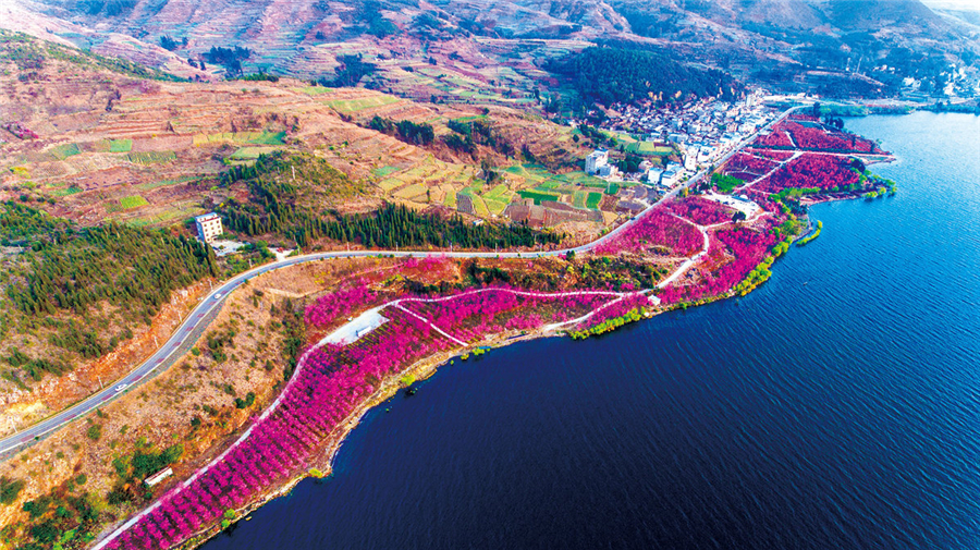
The rivers within Yuxi City belong to two major water systems: the Pearl River and the Red River. Xinping, Yimen, and Yuanjiang counties and part of Eshan County belong to the Red River system, with a total drainage area of 9,981 square kilometers. Red Tower District, as well as Tonghai, Huaning, Chengjiang, Jiangchuan counties, and part of Eshan County belong to the Pearl River system, with a drainage area of 5,044 square kilometers. The city also features plateau graben lakes such as Fuxian Lake, Xingyun Lake, and Qilu Lake.


