Nujiang Geography
Location and Administrative Divisions
Nujiang Lisu Autonomous Prefecture is located in the northwest part of Yunnan Province, between 98°09′ to 99°39′ east longitude and 25°33′ to 28°23′ north latitude. It bord
ers Dehong Dai and Jingpo Autonomous Prefecture, Dali Bai Autonomous Prefecture, Lijiang City to the east, Myanmar to the west, Baoshan City to the south, and Chamdo City, Tibet Autonomous Region to the north. The prefecture shares a border of 449.467 kilometers. It spans a maximum distance of 320.4 kilometers north to south and 153 kilometers east to west, covering a total area of 14,703 square kilometers.
Terrain and Landforms
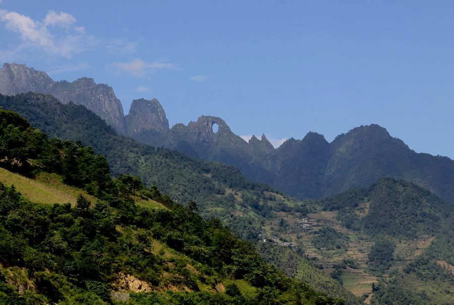
The terrain in Nujiang Lisu Autonomous Prefecture varies significantly from north to south. Four major mountain ranges—Dulongjian, Gaoligong, Biluo, and Yunling Mountains—run north to south, while the prefecture is characterized by the convergence of three rivers: Dulong River, Nu River, and Lancang River. This creates the distinctive “four mountains and three rivers” landscape. The Nu River Grand Canyon stretches 316 kilometers with an altitude difference exceeding 5,000 meters and an average depth of 2,000 meters. The canyon takes a U-shape during the flood season and a V-shape during the dry season. Over 98% of the prefecture’s area is dominated by high mountains and deep valleys. Nujiang is home to over 40 peaks above 4,000 meters, with Mount Gha Wa Gapu (Chulu La’ka Peak) of Gaoligong Mountain being the highest at 5,128 meters above sea level. This peak features a modern hanging glacier extending approximately 3 kilometers, with its tongue reaching down to 4,000 meters altitude. The lowest point in the prefecture is Cold Water Gully in Manyun Village of Lushui City, at an altitude of 738 meters.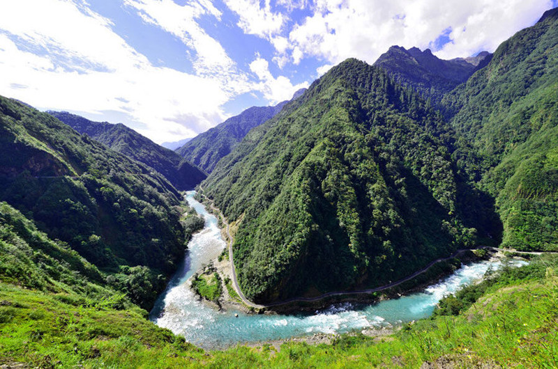
Climate
Nujiang Lisu Autonomous Prefecture experiences diverse and variable weather patterns. Its climate combines characteristics of Yunnan’s low-latitude plateau monsoon climate—small annual temperature differences, large diurnal temperature variations, distinct wet and dry seasons—with variations due to topographical and latitudinal differences. The prefecture exhibits a gradient from cold in the north, moderate in the central regions, and hot in the south; high mountains are cold, mid-slopes are temperate, and riverbanks are hot. Some areas experience early rainy seasons, brief dry seasons, prolonged warm seasons, and distinct climatic characteristics due to its unique geographical features. Northern regions like Fugong and Gongshan have two rainy seasons: the “peach blossom flood” or “spring flood” from February to April, and the main rainy season from May to October.
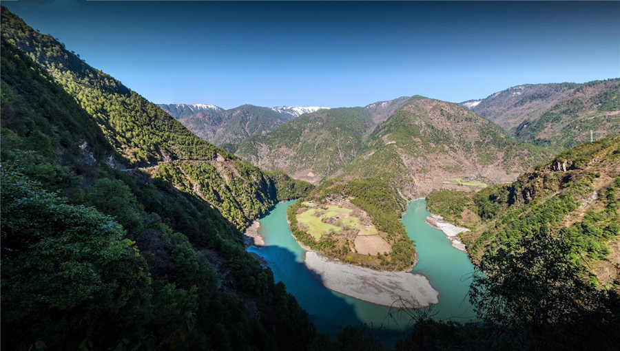 The First Bend of Nujiang River in Gongshan, Nujiang-13
Climatic Data:
- Annual average temperature: 15.8℃
- Average temperature of hottest month: 22.2℃
- Average temperature of coldest month: 9.1℃
- Extreme highest temperature: 40.3℃
- Extreme lowest temperature: -10.2℃
- Annual average precipitation: 1301.9 mm
- Maximum average monthly precipitation: 214.1 mm
- Minimum average monthly precipitation: 18.6 mm
Rainfall Distribution:
- Fugong and Gongshan (Feb-Apr): 591.4 mm (36% of annual precipitation)
- Fugong and Gongshan (May-Oct): 899.7 mm (55% of annual precipitation)
- Lushui and Lanping (May-Oct): 827.15 mm (84% of annual precipitation)
Average wind speed: 1.1 m/s, predominantly from the south. Annual average sunshine hours: 1576.8 hours. Annual average evaporation: 1420.2 mm.
Hydrology
Nujiang Lisu Autonomous Prefecture is densely crisscrossed with rivers, belonging to four major river systems: Nu River, Lancang River, Irawaddy River, and Yangtze River. The prefecture boasts a total of 292 rivers, categorized by their drainage basin areas:
- 6 rivers with drainage areas greater than 500 square kilometers
- 30 rivers with drainage areas between 500 and 100 square kilometers
- 53 rivers with drainage areas between 100 and 50 square kilometers
- 203 rivers with drainage areas less than 50 square kilometers

Soil
The prefecture’s soils are diverse, featuring 11 soil types, 29 soil subgroups, and 55 soil species. Soils vary in acidity, with soils in Lushui, Fugong, and Gongshan tending towards acidity, while those in Lanping tend towards alkalinity. Soils have high organic matter content and are rich in potassium. Soil types vary by altitude:
- Below 1500 meters: predominantly red soils
- Around 2000 meters: yellow-red and yellow-brown soils
- 2500-3000 meters: brown and dark brown soils
- Above 3000 meters: grey-brown forest soils and alpine meadow soils
These sections provide a comprehensive overview of Nujiang Lisu Autonomous Prefecture’s geography, climate, hydrology, and soil composition, showcasing its rich natural diversity and environmental characteristics.