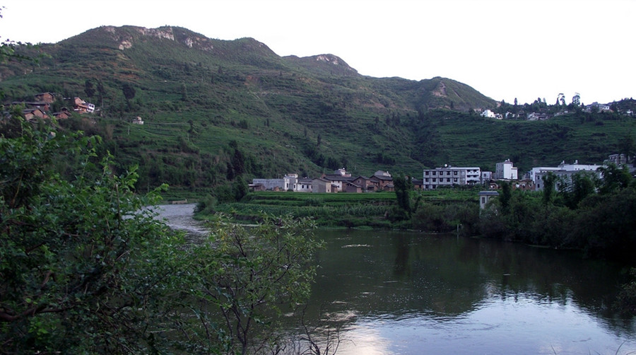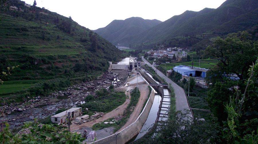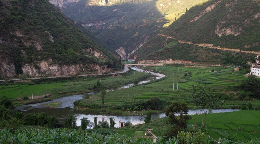
Tanglangchuan-Puduhe River in Kunming
Puduhe River (普渡河) is a major tributary of the Jinsha River (金沙江) on the right bank, located in the central part of Yunnan Province (云南省), People’s Republic of China. The river originates from Chalaqing (喳拉箐) on the northern foothills of Liangwang Mountain (梁王山) in Songming County (嵩明县) at an elevation of 2,600 meters. It flows through various districts and counties, including Guandu District (官渡区), Panlong District (盘龙区), Wuhua District (五华区), Xishan District (西山区), Chenggong District (呈贡区), Jinning County (晋宁县), Anning City (安宁市), Fumin County (富民县), and Luquan County (禄劝县). The river empties into the Jinsha River about 1 kilometer northeast of Heiquxiaopingzi (黑区小河坪子) in Luquan County.
The total length of Puduhe River is approximately 380 kilometers, with a drop of around 1,850 meters and an average slope of about 4.9‰. The watershed area covers approximately 11,090 square kilometers, with over 9,400 square kilometers within Kunming City (昆明市), accounting for about 85% of the Puduhe River watershed. It is conventionally divided into four sections: Panlong River (盘龙江), Dianchi Lake (滇池), Tanglangchuan (螳螂川), and the lower section of Puduhe River (普渡河下段).
General Information
- Chinese Name: 普渡河
- Water System: A tributary of the upper Yangtze River (长江) and Jinsha River (金沙江)
- Geographical Location: Kunming City, Yunnan Province
- Flowing Regions: Songming, Kunming urban area, Anning, Xishan, Fumin, and Luquan (Dongchuan)
- Source: Chalaqing on the northern foothills of Liangwang Mountain, Songming County
- Watershed Area: 11,090 km²
- Average Flow Rate: 91.2 m³/s
- Total Length: Approximately 380 kilometers
Main River Overview
Puduhe River flows through the central and northern parts of Yunnan Province. It originates from Haikou (海口) on the southwestern shore of Dianchi Lake, flowing north through Xishan District (西山区) in Kunming City and the counties of Anning, Fumin, and Luquan, before merging into the Jinsha River in the northeastern part of Luquan County. Its total length is 379.6 kilometers, with a watershed area of 11,089 square kilometers. The average annual flow rate is 101 cubic meters per second, and the annual runoff is approximately 2.3 billion cubic meters.
Puduhe River originates from Dianchi Lake (滇池) and flows through Xishan District (西山区) in Kunming City, Anning, and Fumin counties, generally flowing from south to north before finally emptying into the main Jinsha River at Xiaopingzi Village (小坪子村) in Luquan County. The river is approximately 379.6 kilometers long, with an average slope of 4.88‰ and a drainage area of 11,083 square kilometers.
The section from Dianchi Lake to the Yongding Bridge (永定大桥) in Fumin County is known as Tanglangchuan (螳螂川), while the segment below Yongning Bridge (永宁大桥) is referred to as Puduhe River. The Tanglangchuan section measures 200.3 kilometers and is the only outlet of Dianchi Lake, flowing through Anning Pingba before the riverbed deepens. The valley gradually opens up at Yongding Bridge. This section receives several tributaries, including Mingyi River (鸣矣河), Muban River (木板河), Daying River (大营河), Qingshui River (清水河, also known as Tuodan River or 拖担河), Longna River (龙纳河), and Sandan River (散旦河).
Panlong River
Panlong River (盘龙江) is the upstream section of Puduhe River. It originates from the confluence of Mu Yang River (牧羊河) and Dianwei River (甸尾河) at Chahezhui (岔河嘴) in Guandu District (官渡区). It flows through Guchangba Reservoir (谷昌坝水库), exiting Songhuaba Reservoir (松华坝水库) and passing through the urban area of Kunming, ultimately flowing into Dianchi Lake at Hongjia Village (洪家村). The river is 93.5 kilometers long, with a watershed area of 903 square kilometers and an average annual runoff of 165 million cubic meters. The elevation of the watershed ranges from 2,280 to 1,890 meters, with a gentle slope.
Dianchi Lake
Dianchi Lake (滇池) is the largest lake in the upper reaches of the Yangtze River (长江), located between longitudes 102°36′ to 102°47′ and latitudes 24°40′ to 25°02′. It is situated in a watershed region between three major water systems: the Yangtze River, the Red River (红河), and the Pearl River (珠江). Dianchi Lake is a limestone fault lake formed under the influence of the Himalayan uplift in the Tertiary period. Surrounded by mountain ranges, it belongs to the eastern branch of the Yunling Mountain Range (云岭山脉). There are dozens of peaks surrounding the lake, with the western part of the lake adjacent to the foot of the Xishan Mountain (西山), while the other three sides consist of river alluvial and lake sediment plains. This creates a semi-circular distribution of plains and hills around the lake.
Tanglangchuan
Tanglangchuan (螳螂川) begins at the outlet of Dianchi Lake and flows into Anning, passing through Shilong Dam Power Plant (石龙坝电厂) and reaching Tongxian Bridge (通仙桥). The section extends to Wengquan (温泉) and Qinglong Temple (青龙寺), ending at Yongding Bridge in Fumin County. It measures 97.6 kilometers in length, with elevations ranging from 1,884 to 1,700 meters and a drainage area of 5,178 square kilometers. Major tributaries include Mingyi River, Shuanghe River (双河), Maliao River (马料河), Sha River (沙河), Xianjie River (县街河), Luji River (禄脿河), Dianwei River (甸尾箐河), and Luze River (律则河). The notable tributary, Mingyi River, is 77 kilometers long, with a watershed area of 908 square kilometers and an average annual runoff of 187 million cubic meters, making it a significant irrigation river for Anning City.
Lower Section of Puduhe River
The lower section of Puduhe River starts from Yongding Bridge and flows through areas including Mailong, Zhebei, Yiwut, Chahe, Tiesuo Bridge (铁索桥), Lao Chicken Street (老鸡街), Lezuoni (乐作尼), and Jidu, ultimately merging into the main Jinsha River about 1 kilometer northeast of Xiaopingzi Village in Luquan County. This section measures 156.2 kilometers in total. Major tributaries include Dahe River (大合河), Longzhaba River (龙闸坝河), Zhangjiu River (掌鸠河), Muban River, Xima River (洗马河), Zhongping River (中屏河), Wumeng River (乌蒙河), Shugu River (舒姑河), and Jidu River (基多河). The larger tributary, Zhangjiu River, originates from Fanglaogu (放老姑) in Sanyingpan Town (撒营盘镇) of Luquan County, measures 129 kilometers in length, and has a watershed area of 1,933 square kilometers (of which 1,421 square kilometers is within Kunming). It runs vertically through Luquan County from north to south with a drop of 1,010 meters, serving as a major irrigation river for the county, with significant hydropower potential.
The section from Yongding Bridge in Fumin County to the mouth of the Jinsha River is considered the lower segment of Puduhe River, measuring 156.2 kilometers. Its main tributaries include Daying River, Longzhaba River, Zhangjiu River, Muban River, and Xima River. The upper and middle sections are located within the flat area of Kunming, while the lower sections are characterized by mountainous canyons, with a usable drop of 484 meters and hydropower potential of approximately 720,000 kilowatts, suitable for dam-based development.
Tributaries
The tributaries of Puduhe River mainly include three rivers: Zhangjiu River (掌鸠河) on the left bank, and Mangzhai River (蟒寨河) and Xima River on the right bank. Most tributaries originate from the plateau and plain areas, with small watershed areas, short lengths, and concentrated drops at the mouths where they join the main river. The average annual flow rate of Puduhe River is about 95 cubic meters per second, leading to a total annual runoff of 2.95 billion cubic meters. The major tributaries include Daying River, Luji River, Muban River, Qingshui River, and Zhangjiu River.
Summary
Puduhe River is a significant waterway in Yunnan, playing a crucial role in irrigation and hydropower generation. It flows through various scenic areas and contributes to the ecological balance in the region. The river’s tributaries also enhance the local water supply and support agricultural development.


