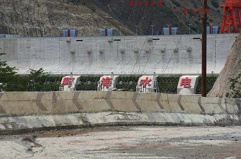
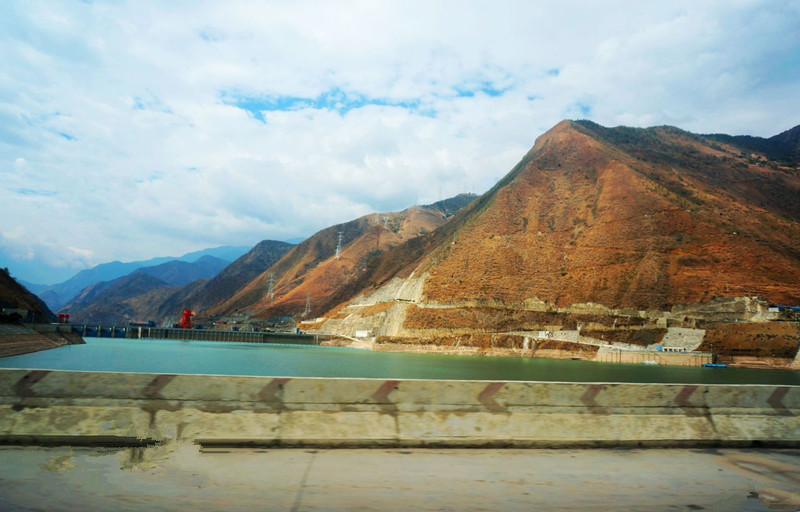
Ahai Dam and Ahai Hydropower Station in Yulong County, Lijiang
The Ahai Dam (阿海水电站) is a gravity dam on the Jinsha River in Yulong County, Lijiang Prefecture, Yunnan and in the river reach at about 5 km in the lower reaches of Cuiyu River mouth. Preliminary construction began in 2008 and construction on the dam superstructure and power station began in 2010. The dams first generator was operational in December 2012, the third by May 2013.[1][2] The fifth and final generator was commissioned on 9 June 2014.
Overview
The Ahai Hydropower Station (阿海水电站) is the fourth tier of the “one reservoir and eight levels” development scheme recommended in the “Hydropower Planning Report for the Middle Reaches of the Jinsha River (金沙江中游河段水电规划报告).” It connects upstream with the Liyuan Hydropower Station (梨园水电站) and neighbors the Jin’anqiao Hydropower Station (金安桥水电站) downstream. This station is a vital power source for the Jinsha River Hydropower Base, with a maximum dam height of 130 meters, a total reservoir capacity of 882 million cubic meters, and an effective capacity of 218 million cubic meters, providing daily regulation capability.
The station has a total installed capacity of 2 million kilowatts and an average annual power generation of 8.877 billion kWh, with a static investment of approximately 13.6 billion yuan.
The primary focus of the Ahai Hydropower Station is power generation, with additional benefits in flood control and irrigation, making it significantly important for regional economic development and the implementation of the “West-to-East Power Transmission” strategy.
General Information
- Chinese Name: 阿海水电站
- Location: Yulong Naxi Autonomous County (玉龙纳西族自治县), Lijiang City (丽江市), Yunnan Province (云南省)
- Opening Hours: Open all day
- Ticket Price: Free
- Notable Attractions: Ahai Hydropower Station Rare Plant Garden (阿海水电站珍稀植物园)
- Upstream Station: Liyuan Hydropower Station (梨园水电站)
- Downstream Station: Jin’anqiao Hydropower Station (金安桥水电站)
- Waterway: Upper reaches of the Yangtze River (长江), Jinsha River (金沙江)
- Total Installed Capacity: 2 million kilowatts
- Average Annual Power Generation: 8.877 billion kWh
- Country: China (中国)
- City: Lijiang (丽江市), Yunnan Province (云南省)
- Recommended Visit Duration: 1 hour
- Best Season to Visit: Summer (夏季)
- Reservoir Capacity: 806 million m³ (有效库容2.18亿m³)
Project Overview
The dam site of the Ahai Hydropower Station is located at the junction of Yulong County (玉龙县) and Ninglang County (宁蒗县) along the middle reaches of the Jinsha River. The project is a comprehensive hydraulic and hydropower hub focused on electricity generation, with additional roles in flood control and irrigation. The dam is classified as a major (1) grade project, with permanent main hydraulic structures designed as first-grade constructions.
The project consists of a concrete gravity dam, a left bank overflow surface hole, energy dissipation pool, left bank flood discharge sand flushing hole, right bank sand discharge hole, and main auxiliary power houses behind the dam. The maximum dam height is 130 m, and the normal water level is set at 1504.00 m, with a corresponding reservoir capacity of 806 million cubic meters.
The dead storage level is 1492.00 m, with a dead storage capacity of 700 million cubic meters and an adjustable reservoir capacity of 106 million cubic meters. This classification marks it as a daily regulated reservoir. The total installed capacity of the station is 2000 MW, with an average annual power generation of 8.877 billion kWh. The total construction period for the project is 98 months, with the dam’s first unit expected to generate power by December of the seventh year. The total static investment is approximately 13.6 billion yuan.
Reservoir Area
Once the dam is completed, the normal water level will create a reservoir capacity of 806 million cubic meters, with a total capacity of 882 million cubic meters and a regulation capacity of 238 million cubic meters. The Ahai Hydropower Station reservoir reaches a water level of 1504 m, with a backwater length of approximately 75.3 km, affecting four counties: Muli County (木里县), Yulong County (玉龙县), Ninglang County (宁蒗县), and Shangri-La County (香格里拉县) in the Liangshan Prefecture (凉山州), Lijiang City (丽江市), and Diqing Prefecture (迪庆州).
The total inundation area due to the reservoir is approximately 23.42 square kilometers, comprising 15.9 square kilometers of land and 7.52 square kilometers of water. The submerged area affects 2655 mu of arable land, 2865 mu of protective forest land, and 29431 mu of unused land. There are 34 affected village residential areas, with a total submerged population of 623.
The reservoir creates approximately 22.67 square kilometers of usable water surface, providing a beautiful setting that promotes local tourism development.
Land Acquisition and Resettlement
The land acquisition for the Ahai Hydropower Station involves Yulong County (玉龙县), Ninglang County (宁蒗县), Shangri-La County (香格里拉县) in Diqing Prefecture (迪庆州), and Muli County (木里县) in Liangshan Prefecture (凉山州). The construction area is characterized by sparse population and rugged mountain gorges, with 8424 mu of farmland submerged and a planned relocation population of 2538 people.
The resettlement for the Ahai Hydropower Station is notable for its minimal land submergence and few displaced people compared to other hydropower projects of similar scale, presenting unique developmental advantages. The resettlement planning report for this project is the first large-scale hydropower engineering resettlement planning report prepared according to the “Regulations on Land Acquisition Compensation and Resettlement for Large and Medium-sized Water Conservancy and Hydropower Projects” (State Council Order No. 471) and the 2007 edition of the “Planning and Design Specifications for Resettlement in Hydropower Engineering Construction,” providing valuable experience for similar national projects.
Transportation to the Station
The dam site is approximately 130 km from Lijiang City (丽江市), 636 km from Kunming City (昆明市), and 299 km from Panzhihua City (攀枝花市). The eastern railway line has been connected to Geli Ping and links to Chengkun Railway via the Panzhihua-Geli Ping branch line. The southern railway line has reached Dali (大理), and construction on the Dali to Lijiang railway has commenced, projected to be completed by 2008.
The left bank of the hydropower station is in Ninglang County (宁蒗县), and the right bank is in Yulong County (玉龙县). The transportation status from Ninglang County to the dam site includes a 32 km fourth-grade road to Hongqiao Township (红桥乡) and a 22 km non-standard road to Cuiyu Township (翠玉乡), followed by a 19.2 km simple road leading to Kuzhi Village (库枝村).
Background
The dam section is a transverse valley with a water surface 60 to 150 m wide and low water level of 1048 m. The landforms on both banks are basically symmetrical. There is a measurement of about 50 m wide tableland and about 30 degrees above water surface in the left bank, and the slope in the right bank is about 27 degree and the slope above the elevation of 1500 m is about 48 degree. There is poor sand and soil materials and abundant limestone material satisfied with requirement of quality and reserves within 20 km in the dam area, which is qualified for setting up low dam according to existing geological data. In the light of topographic and geological conditions, the Ahai Dam section can be considered as local material dam type with low height of swell, suitable for connection of backwater with Liyuan cascade. The dam has normal water level of 1514 m, total reservoir capacity of 1.08 billion cubic meters and installed capacity of 2,000,000-2,200,000 kW. Now, a low-cost road to Niukexu has been opened to traffic, and there is only an about 5 km long path to the dam section.
Environmental impact
This project marked the first time representatives from Chinese environmental groups were invited to participate in the environmental impact assessment for a major hydropower project in China, according to the First Financial Daily. Representatives of the Institute for Public & Environmental Affairs and the Green Earth Volunteers took part in the meeting to conduct technical evaluation on environmental impact assessment for the dam on the Jinsha River on December 29–30, 2008 in Beijing.


