 7 Days GolfingTour
 8 Days Group Tour
 8 Days Yunnan Tour
 7 Days Shangri La Hiking
 11 Days Yunnan Tour
 6 Days Yuanyang Terraces
 11 Days Yunnan Tour
 8 Days South Yunnan
 7 Days Tea Tour
 8 Days Muslim Tour
 12 Days Self-Driving
 4 Days Haba Climbing
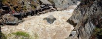
 Tiger Leaping Gorge
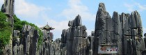
 Stone Forest
 Yunnan-Tibet
 Hani Rice Terraces
 Kunming
 Lijiang
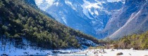
 Shangri-la
 Dali
Dali
 XishuangBanna
 Honghe
 Kunming
 Lijiang
 Shangri-la
 Yuanyang Rice Terraces
 Nujiang
 XishuangBanna
 Spring City Golf
 Snow Mountain Golf
 Stone Mountain Golf

Mountains in Puer
Mountains in Puer are the most favored by hiking tourists, such as the magnificent Puer Mountain, the lofty Fahan Mountain, Baima Mountain. Most mountains in Puer are the best places to take a Puer Hiking Tour.


Mountains in Puer are the most favored by hiking tourists, such as the magnificent Puer Mountain, the lofty Fahan Mountain, Baima Mountain. Most mountains in Puer are the best places to take a Puer Hiking Tour.
Overview Nanlei River (南垒河, Nánlěi Hé), known in Dai language as “Chasing Husband River,” originates in the northern part of Laba Township, Lancang Lahu Autonomous County (澜沧拉祜族自治县, Láncāng Lāhù...
Chinese Name: 孟连县法罕山 English Name:Fahan Mountain in Menglian County, Puer Address: North of Menglian County, Pu’er City Introduction: Fahan Mountain, located about 2 kilometers north of Menglian County, is...
Wuliangshan Mountain Wuliang Mountain, formerly known as Mengle mountain (蒙乐山), is located in the west of Jingdong Yi Autonomous County, Pu’er City, Yunnan Province, between 23 ° 57 ‘-...


