 7 Days GolfingTour
 8 Days Group Tour
 8 Days Yunnan Tour
 7 Days Shangri La Hiking
 11 Days Yunnan Tour
 6 Days Yuanyang Terraces
 11 Days Yunnan Tour
 8 Days South Yunnan
 7 Days Tea Tour
 8 Days Muslim Tour
 12 Days Self-Driving
 4 Days Haba Climbing
 Tiger Leaping Gorge
 Stone Forest
 Yunnan-Tibet
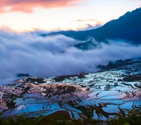
 Hani Rice Terraces
 Kunming
 Lijiang
 Shangri-la
 Dali
Dali
 XishuangBanna
 Honghe
 Kunming
 Lijiang
 Shangri-la
 Yuanyang Rice Terraces
 Nujiang
 XishuangBanna
 Spring City Golf
 Snow Mountain Golf
 Stone Mountain Golf
Abujicuo Pasture in Shangrila, Diqing
Attraction Overview
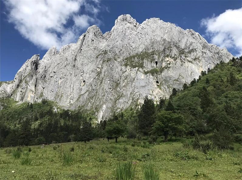
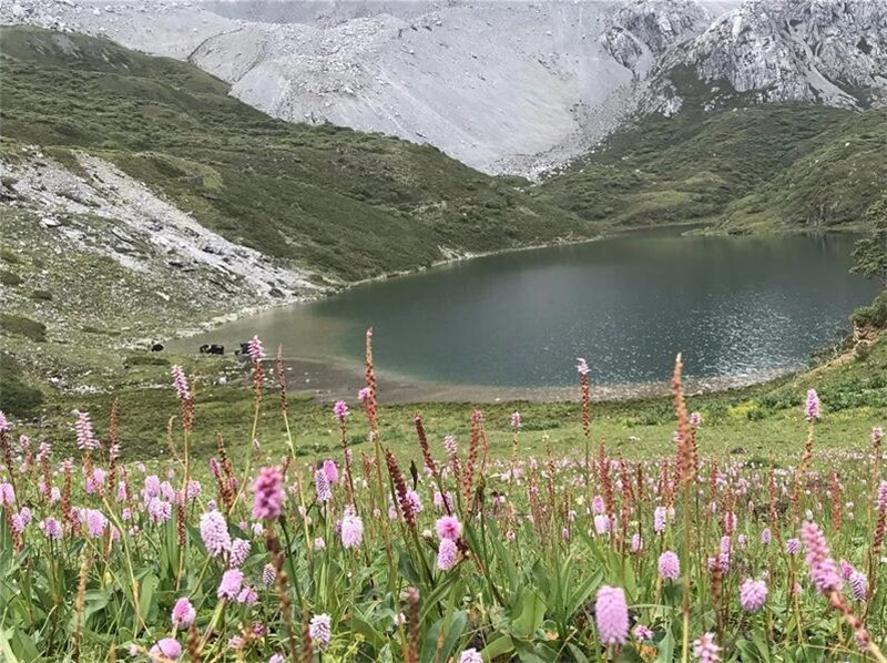
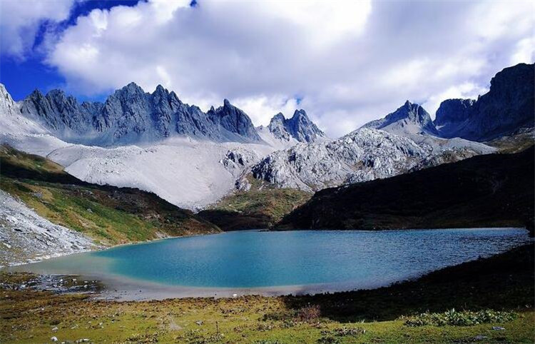
Abuji Pasture is located at the foot of Tianbao Snow Mountain, which is the most beautiful mountain lake of Tianbao Snow Mountain.
Attraction Type: Pasture
Chinese Name: 阿布吉牧场(Abuji Muchang)
Recommended Visiting Time: 1 Day
Open Hours: All Day Long
Altitude: 3800 m
Location: at the foot of Tianbao Snow Mountain, Shangri-La City, Diqing Prefecture of Yunnan Province
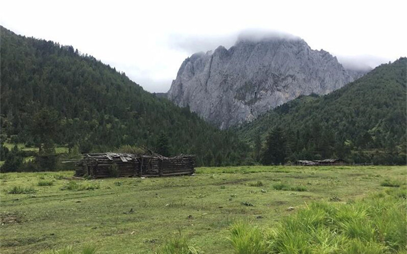
Abuji Pasture is located at the foot of Tianbao Snow Mountain, which is the most beautiful mountain lake of Tianbao Snow Mountain. It gives a strong sense of change and variation, crystal water, green forest, white snow mountains, as well as the snow mountains plated with gold when sunset. Showing an isolated snow mountain landscape painting in front of us which makes us indulged it.![]()
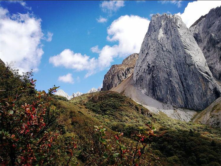
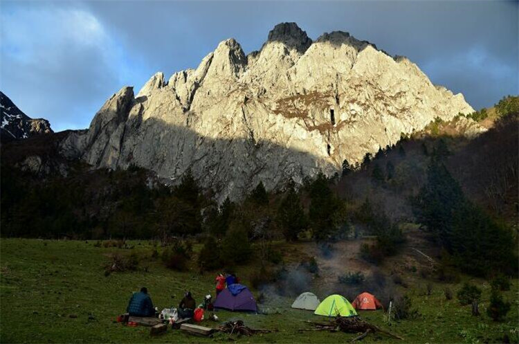
There are many hiking opportunities near Shangri-La, but this is one of the more spectacular yet easy ones. Rather unknown and not well connected with roads, hiking to Abujicuo (Abuji Lake, 阿布吉措) is a nice daytrip away from the crowds and tourist attractions of Shangri-La in Northern Yunnan, China.
Abujicuo has recently become a bit more well-known and now attracts locals as well as outdoor-loving tourists. But even though it has stunning views and is quite close to Shangri-La, not many people are visiting due to the rather underdeveloped infrastructure. Thus, the hike to Abujicuo is perfect for you if you’d like to be independent and do your own thing (just as we do).
The hike is easy and offers great views of the valley, mountains and lake. You’ll also see local farmers, herds of yaks, horses and pigs.![]()
Naming
“Cuo” (措) is the Mandarin Chinese spelling for the Tibetan word “tso”, meaning lake. Many lakes in the Tibetan areas of Yunnan, Sichuan, Qinghai, and of course Tibet itself are named with “cuo” in the end.
Legend has it that Abujicuo was undiscovered for a long time. One day, a farmer lost a cow called “Abu” and set out to search for it. During the search, he kept shouting “Abu”, and finally found the animal near this lake. Henceforth, it was called “Abuji Lake” or Abujicuo.
Getting to the Abujicuo trailhead
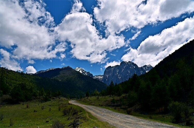
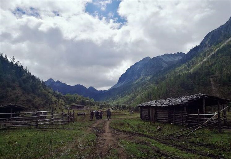
The trail to Abujicuo (阿布吉措) starts in a valley east of Xiaozhongdian (小中甸), about 30km south of Shangri-La/Zhongdian in Yunnan. The closest points on a regular street map might be Xiaozhongdian Forest Farm (小中甸林场) or Yangtang Dejilin Temple (阳塘德吉林寺). From the Forest Farm or Temple, follow a bumpy dirt road into the valley for about 12km to reach the starting point of the trail.![]()
Getting to the trailhead: From G214 (orange) via the dirt road (yellow) to the trail (red), (c) Google Earth
By car: From Shangri-La, drive G214 south towards Lijiang for about 30km/30 minutes until reaching Xiaozhongdian Forest Farm (小中甸林场). Turn left off the main road and onto a gravel/dirt road that passes below the newly built highway and high-speed train bridges. Follow this road into the valley (do not drive up to the temple) until you reach the trailhead (see GPX route below). Driving time along the dirt road is another 20-30 minutes. Just before reaching the trailhead, take the right road at a major fork. Except for this one fork, there aren’t any junctions or other roads, so you won’t get lost. Due to the road condition, it’s advised to drive a larger vehicle (SUV-type) with enough ground clearance, and not your average VW Santana sedan (although we did see some locals driving old Geely sedans and not getting stuck, so it should be possible…).
By bicycle: You can basically follow the car instructions from above. Road G214 from Shangri-La to Xiaozhongdian is paved and in excellent condition. The dirt road into the valley is not in good condition, but should be fun to ride with a proper mountain bike. Mind the altitude gain, though: From the start of the dirt road (3200m) to the trailhead (3600m) is an altitude gain of 400m.
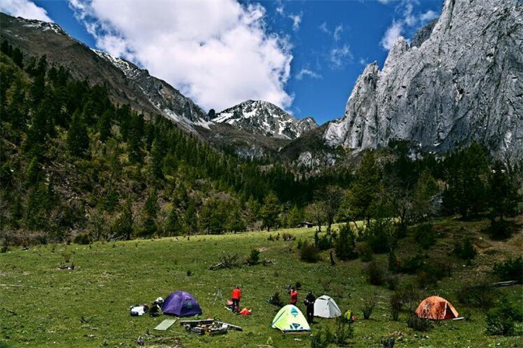
By public transport: Long-distance busses between Shangri-La and Yunnan should be passing the Xiaozhongdian Forest Farm. Ask the driver to get off here. You’ll still have to hike up through the entire 12km valley to get to the starting point, though. The dirt road is marked as a hiking trail (there are signs in Chinese & English declaring it as such), and the valley views are stunning, with small wooden huts and grazing yaks. Doing the entire valley on foot will probably turn this into a two-day hike.
By tour: If you can’t or don’t want to make the way to Abujicuo yourself, there are a few tour operators in Shangri-La offering excursions in small groups (10-20 people). We’ve read these cost around 248 RMB per person and include transportation as well as BBQ lunch on the way back. Just ask your guest house or one of the tour operators in the old town for more information.![]()
Rumors of entrance checks and necessary guides
We’ve heard from various people around Shangri-La that it would be necessary to hire a local guide to hike to Abujicuo, otherwise the villagers wouldn’t let you into the area. This information can also be found online (in Chinese) on certain outdoor forums. However, it’s not correct: You do not need a guide to hike to Abujicuo. We just drove to the trailhead ourselves and did the hike, and met a few other hikers (locals and mainland tourists from other provinces) doing the same. Do not be discouraged by people in Shangri-La telling you that you’re not allowed to do this hike yourself, they just want your money!
There is a guard station with gate at the entrance of the valley (on the first kilometer of the dirt road), but the gate was open and the place was unmanned both when we came and left. Nobody checked us or required us to do any kind of registration.
Trail overview and route
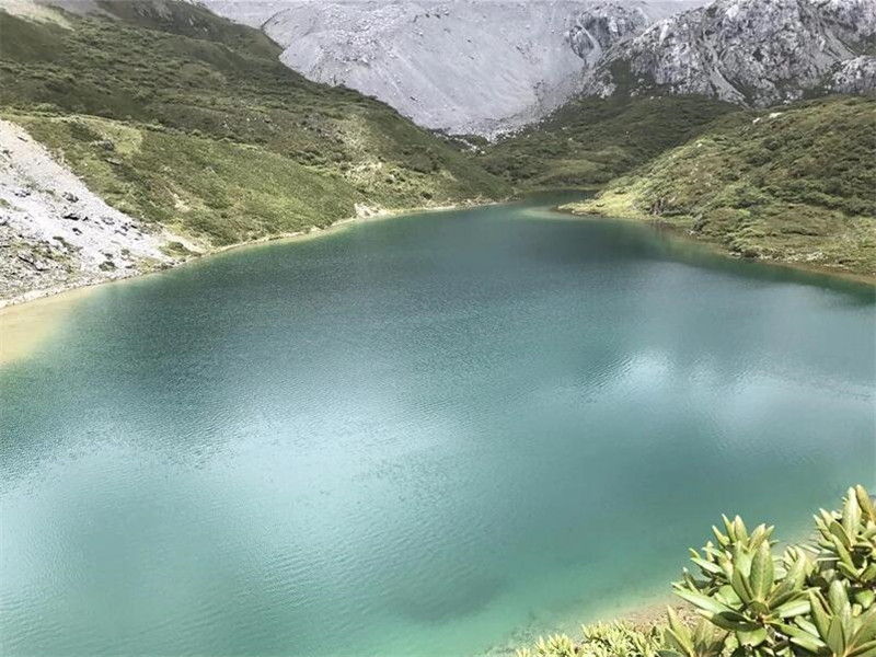
The roundtrip from trailhead to Abujicuo and back is about 9km and takes 4-6 hours, depending on your pace and resting time. It took us about two hours for the ascent to the lake, and one and a half hours for the descent. At the lake, take a rest to admire the views and enjoy the tranquility. You can also do a short walk around the lake (about 30 minutes).
Trail to Abujicuo overlaid on Satellite Imagery (c) Google Earth
The trail is always well visible, but we’d recommend taking the GPX trace (below) as reference. The KML file additionally includes the (rough) driving instructions with G214 and dirt road included. The trailhead is at the following coordinates: 27.65350/99.88252.
abujicuo_hiking_gpxDownload
abujicuo_hiking_with_driving_kmlDownload
You can also find various traces in outdoor apps such as foooooot.com (六只脚) or 2bulu (两步路) by searching for the Chinese name of Abujicuo: 阿布吉措.
Pastures and cottages in the valley. The trailhead is just in front.
Impressions from the hike
In the first few minutes, the trail is rather flat and crosses a few creeks. Simple bridges made of felled trees are provided to help you cross. After a few minutes, you’ll reach an open meadow with grazing yaks, black pigs and a few wooden huts.
Bridge across creek at the beginning of the trail
After passing the huts, there’s another river crossing, and then the steep ascent begins. Just follow the trail uphill until you reach a section where you have to walk through a shallow river/small waterfall.
Section where you’ll walk through the shallow water
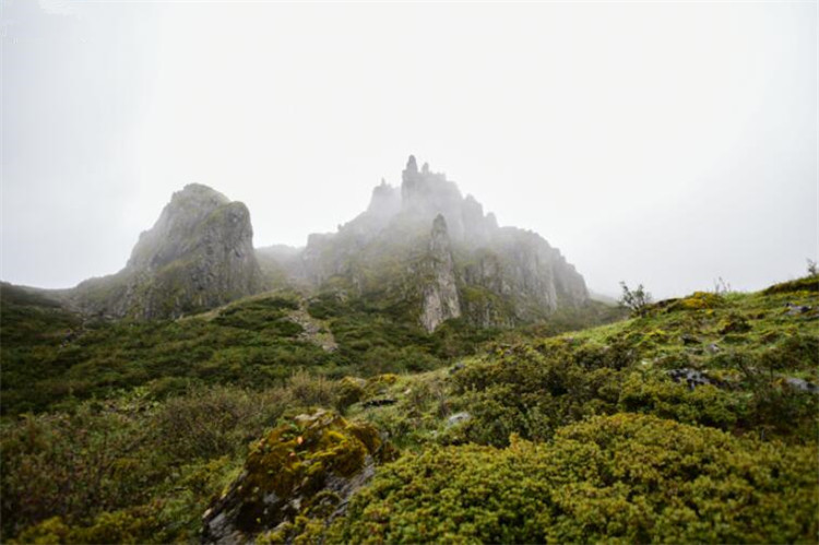
After this section, you’ve nearly reached the lake. A few minutes ahead, you’ll see prayer flags, marking the viewpoint of the lake.
Prayer flags near the lake. Once you see these, you’ve made it!
During the hike, we met a few other hikers: A couple from Harbin (in Heilongjiang province) that drove all the way from their home town to Yunnan. That route is pretty much along the well-known Hu Line that divides China into two parts of equal area, but with 95% of the population living on the south-east of the line. It’s also a driving distance of 4000km, so these two were really determined to see Yunnan. There was also a group of elderly local people from Shangri-La who came to the lake for picnic. Great to see the old folks keeping fit! We always enjoy talking to the other hikers we meet outdoors and listen to their stories, many of them have very interesting backgrounds.![]()
What to bring for hiking to Abujicuo
Here are the essentials we recommend to bring to the Abujicuo hike:
Hiking boots or sports shoes
Warm clothes (hardshell/fleece/down jacket) – it can get quite cold at the lake, no matter how warm it is in the valley
Water bottle – you can refill in the stream and in the lake
Sunscreen
Snacks (trail mix, fruits, beef jerky, snickers, etc)
Camera
Phone with GPS, GPX trace, offline map
Gas cooker and tea leaves (optional)
There’s no shop in the entire valley, so make sure you bring everything you need!
Enjoying some hot tea with a great panorama of Abujicuo at above 4200m
Mobile network coverage
As of October 2021, none of the three mobile phone networks in China (Telecom, Mobile, Unicom) covers the Abujicuo area and the valley. You’ll be completely offline, so prepare accordingly (e.g. download offline map). Obviously, you’ll also not be able to use Wechat/Alipay for paying, but since there’s no shop anyway, that shouldn’t be a big issue. There are some small farms on the way, though, so if you want to buy anything from the farmers, better prepare cash.
Costs & Prices
No entrance fee or ticket required! Hiking to Abujicuo is absolutely free.
Alpine flowers near the lake
Where to go next
There are many great outdoor options in Northern Yunnan and around Shangri-La. Check out these recommendations:
Meili Snow Mountain North Slope (TODO)
Xiagei Wenquan (下给温泉): Natural Outdoor Hot Spring near Shangri-La
Or have a look at other guides, articles and itineraries:
Meili North Slope (梅里北坡): 5 Days Trek Around the Magnificent Meili Snow Mountain (6740m)
Abujicuo (阿布吉措): Day-hike to Stunning Mountain Lake near Shangri-La
Xiagei Wenquan (下给温泉): Natural Outdoor Hot Spring near Shangri-La
Anji River Hike: Jingkongli Grand Canyon (井空里大峡谷)
Riverside Camping in Anji: Hanjiang Campsite (寒江孤影营地)
