
2 Days Dali Hiking Tour from Erhai Lake to Jizu Mountain
The 2-day Dali hiking tour from Erhai Lake to Jizu Mountain is a popular itinerary in Yunnan, China that showcases the stunning landscapes and cultural heritage of the region. Here’s a detailed guide on how to plan and prepare for this hiking trip:
Duration: 2 days and 1 night
Total Distance: Approximately 30 km
Best Time to Visit: March to May and September to November
Day 1: Erhai Lake to Xizhou Town
- Start your hiking tour by arriving in Dali Ancient City, which is located near Erhai Lake
- Take a bus or drive to Erhai Lake, which is about 10 km away from Dali Ancient City
- Hike along the lakeside path and enjoy the beautiful views of the lake and surrounding mountains
- Stop for lunch at a local restaurant in Xizhou Town
- Visit the ancient city of Xizhou, which is known for its historic architecture and cultural heritage
- Spend the night in Xizhou Town
Day 2: Xizhou Town to Jizu Mountain
- Start your day by hiking to Jizu Mountain, which is located about 20 km away from Xizhou Town
- Hike through the lush forests and beautiful landscapes of the mountain
- Enjoy a picnic lunch at the top of the mountain before returning to Xizhou Town
- Visit the Jizu Mountain Temple, which is a UNESCO World Heritage site
- Return to Dali Ancient City in the evening
Note: The hiking routes on Erhai Lake and Jizu Mountain are well-maintained and marked, but it’s always a good idea to bring a map and compass to avoid getting lost. Also, make sure to wear comfortable shoes and bring enough food, water, and sunscreen.
Preparation:
- Research the hiking routes and make sure you are in good physical condition
- Bring a map and compass to avoid getting lost
- Wear comfortable shoes and bring enough food, water, and sunscreen
- Check the weather forecast and pack accordingly
- Obtain any necessary travel permits or tickets in advance
Overall, the 2-day Dali hiking tour from Erhai Lake to Jizu Mountain is a great way to explore the natural beauty and cultural heritage of Yunnan province. By following this guide, you can plan and prepare for a safe and enjoyable hiking trip.
Tour Route: Muxiangping(木香坪) -Jizu Mountain(鸡足山)
This route stretches from the eastern part of Erhai (洱海) to Wase (挖色) and Dacheng Chongfu Temple (大城崇福寺), then passes Fengweiqing (凤尾菁), Niujiao Mountain (牛角山), Muxiangping (木香坪), Taohuaqing (桃花菁), and eventually ends at Jizu Mountain (鸡足山). People include the nobles and civilians of the Kingdom of Dali, the Mu-Family of Lijiang, and Xuyun the Old Monk in the modern times have all taken this route. Until now, this route is still being used by the Bai Nationality of Haidong Wase (海东挖色) and the pilgrims from Tibet. Most importantly, Kassapa Thera has also taken this route to mountain! The reason of choosing this route, is not only because of it passes beautiful scenery spots include Muxiangping High Mountain Meadow (木香坪高山草甸)and Taohuaqing Primitive Forest (桃花菁原始森林), but also because this clockwise-encircling route, which starts from the ancient path of Wase (挖色), is the most propitious from the Buddhism perspective. As it is recorded in Buddhism Classics, the merits and virtues of clockwise-encircling pagoda and the Holy Land, is an appearance of enhancing good method, while anticlockwise refers to depletion and violation. What makes this route more historical is Chongfu Temple (崇福寺) of Wase Dacheng(挖色大城), the old site where Kassapa Thera stayed to sermon before heading for Jizu Mountain (鸡足山). (Kassapa Thera is one of the Buddha’s ten disciples, who was also called the ‘No.1 Mendicant Buddhist Monk’, ‘the No.1 Ascending’ and such).
As far as I know, there are three routes to Jizu Mountain (鸡足山). The first is to head for Muxiangping (木香坪) from Shuanglang Town (双廊镇), which is also the nearest; the second is to go from Changyu Village(长育村), which is two kilometers from Shuanglang Town (双廊镇); and the third is to to go from the road of Wase (挖色). The former two will eventually join the third one. We went to the mountain from Changyu Village(长育村), which is also the relatively more obvious mountain path on the downloaded topographic map.
The total length of the route from Wase Town (挖色镇) beside Erhai (洱海) to Jizu Mountain (鸡足山) is 36.8 kilometers. Detailed time of arrival depends on factors include your load-bearing, whether to take lift or not. Those energetic ones shall finish the whole journey within 9 to 10 hours, and those heavy-loaded ones may have to stay on the mountain top for one day. They could take a ride to Dacheng Village (大成村) or drive to forestry station directly to start hiking, which shall arrive at Jizu Mountain (鸡足山) in one day.
Our journey was divided into two days. On the first day, we arrived at the Home of Forest Ranger Laolee from Changyu Village(长育村). On the second day, we started from Laolee’s Home, then passed Muxiangping (木香坪) to Jizu Mountain (鸡足山). 30 minutes after we crossed Changyu Village(长育村) and arrived underneath the highway bridge, the uphill path started to become very steep. Then after 1.5 hours we have arrived at the road from Wase (挖色) to Muxiangping (木香坪). This section is pretty dry, so we drank a lot of water. Then we went along the flat road, and we saw a lot of small villages. About 4 kilometers later, we turned left at a crossroad, and we headed for the mountain with monotonous scenery along the way. Luckily we caught a sand-transporting vehicle, and reduced our journey for 3.5 kilometers. We then got off at the crossroad to Muxiangping (木香坪). There was a small village down the road, and another crossroad is approximately 2.3 kilometers to the right, while the Home of Forest Ranger Laolee is on the left. However Laolee was not in. Then we camped in the yard after obtaining neighbor’s permission.
If you have walked the whole way, you will need to take the path shown below from Wase Bridge (挖色大桥) to enter Kanghe Road (康盒线). This path is not in good condition, with dirt road serves as former half, gravel road serves as the middle, and flat asphalt road serves as the remaining part. A sign to Rose Garden (玫瑰庄园) will then be found on the crossroad to Dacheng Village (大成村). Fruit trees will be seen along the dirt road to this village. A spring will then be found on the roadside 50 meters to the crossroad to Dacheng Village (大成村), where you can replenish your water resources.
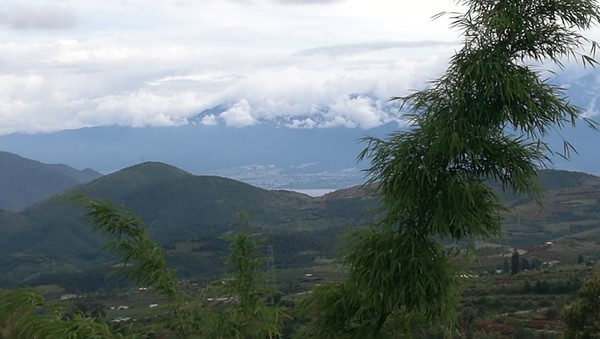
Looking back on the way to Dacheng Village (大成村), we can see our place of departure Erhai (洱海) in distance.
After arriving Dacheng Village (大成村), we went along a shaded path, and a crossroad (big rocks beside the way) appeared. One path is downhill, another is uphill. We took the latter one.
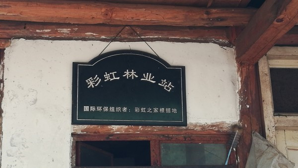
About 40 minutes later we arrived at another crossroad, and we sticked to uphill path again. Once we have seen a roadside house, we know we have reached at Caihong Forestry Station(彩虹林业站). The whole Muxiangping Mountain (木香坪山) is his, and this is the last supply depot where you can replenish your water resources, have an natural and additive-free ecological dinner, or get accommodation. The owner’s surname is Lee ~ 187-8723-6117
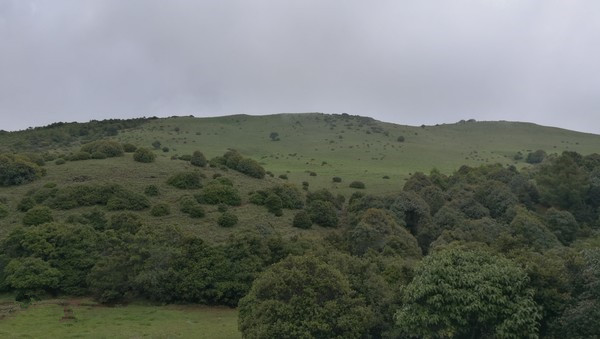
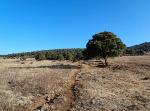
This path was bumpy, and we hoped it doesn’t rain, otherwise it would become a drainage. There were also no cellphone signal and any sign of human habitation, however we would occasionally come across a herbalist. Once you have seen a large lawn, then congratulations on arriving Muxiangping (木香坪), Dali’s peak, with the altitude of 3,970 meters.
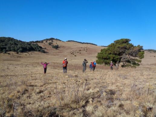
This is indeed a good camping spot. There were two natural springs behind the bushes on the tree of the first photo, and hermits can be found meditating nearby. Surrounding cowsheds can also be used to lodge (please pay attention to strong wind in the night and keep warm, as the temperature drops distinctly). Trash must be taken away, and you will need to pay Laolee 20 Yuan as lawn protection fee, as he owns this land.
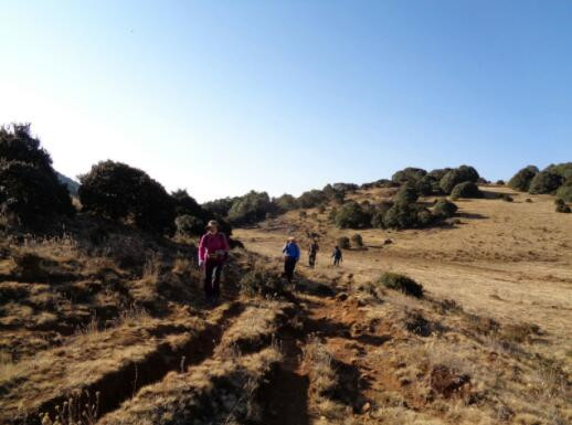
There was a path beside Muxiangping (木香坪), which directly leads to the back of Jizu Mountain (鸡足山). This is the most beautiful part of this journey (go through primitive forest). This is the only way, and the pilgrims would left their prayer flags as leading signs. At the end of this path, you will see the golden top of Jizu Mountain (鸡足山). Then another two paths appeared. The left one leads to the golden top, which required Z-shaped climbing; the right and downhill one leads to Fangguang Temple (放光寺), however it starts with stream. No matter which path you take, it eventually leads you to the scenic area, which makes the ticket unavoidable.
We took a shortcut to Muxiangping (木香坪), and whether we camp or not, we would check out the place where ascetic monk cultivate himself every time. This time it’s an exception as we have taken the shortcut.
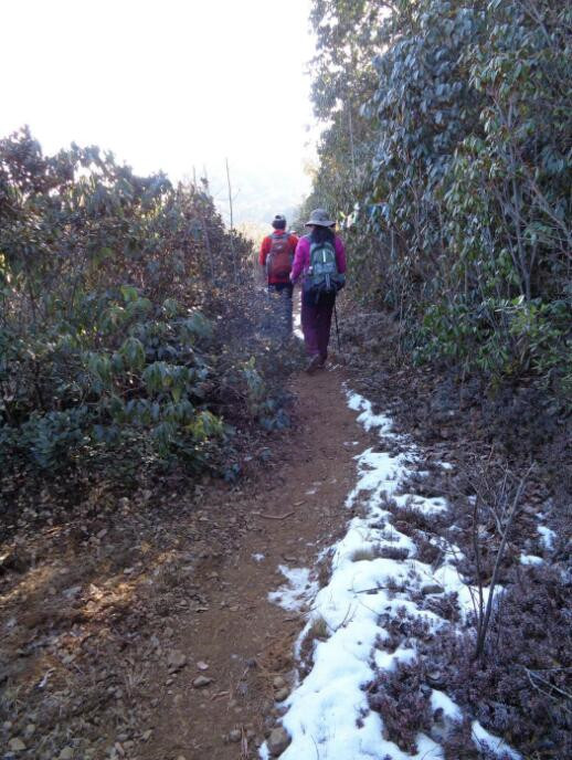
After climbing this puerto over, you can see Jizu Mountain (鸡足山) in distance. It’s all downhill path from here to Taohuaqing (桃花箐), and this is the only snow we have seen today.
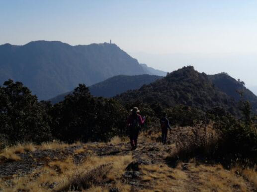
The golden submmit of Jizu Mountain (鸡足山) is in the distance.
It’s basically this kind of downhill path to Taohuaqing (桃花箐), the winding path makes me both relaxed and happy.
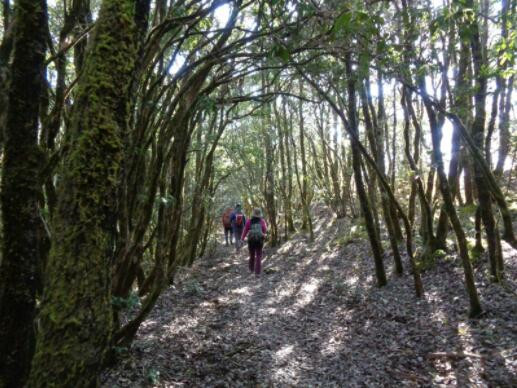
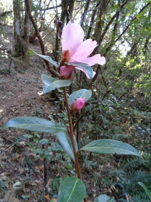
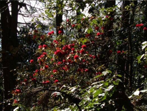
We are happy as we can see the blooming Elsholtzia bodineri Vaniot and Rhododendron on the roadside.
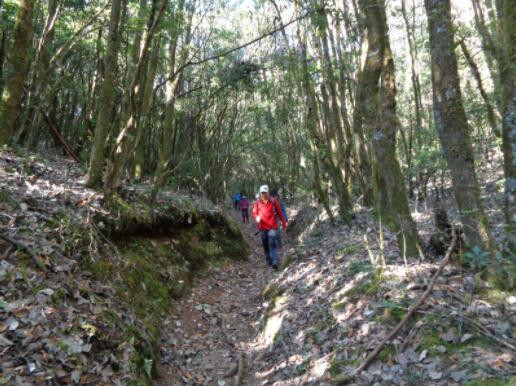
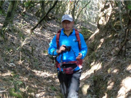
Brother Qi is always ready with his camera, as he doesn’t want to miss any scenery around him.
We can look up at the golden top of Jizu Mountain (鸡足山) after we have arrived at Taohuaqing(桃花箐). The left side of the crossroad leads to Huangping (黄坪) while the right side leads to Huashoumen (华首门) beneath the golden top. The destination is on the hill.
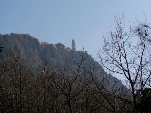
More and more Rhododendron delavayi Franch (马樱花) are blooming up the hill. However the forest is dense, which made the lighting here incomparable to the west slope of Cangshan (苍山).
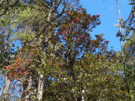
The blooming wild camellia(野山茶) bodineri Vaniot has tall branches, and the sunlight is penetrating their gaps.
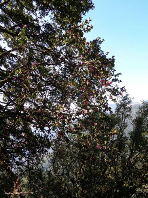
The gold top is not far away, we had our lunch and carry on.
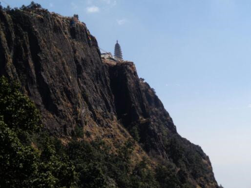
This is the cave used to sit in meditation, where you can see the gold top by raising your head.
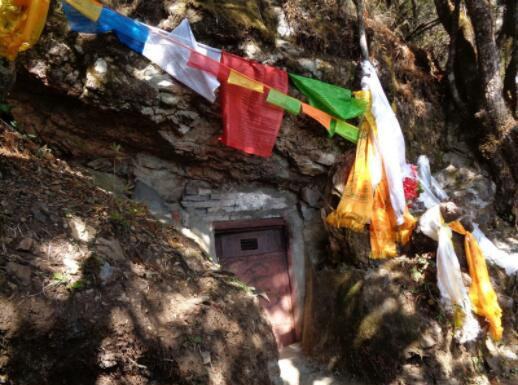
There is an abyss below, and I heard this is the stone where anagarika sits in meditation. These fearless guys made a show in turn, as I stood away, afraid of height. What a close call!
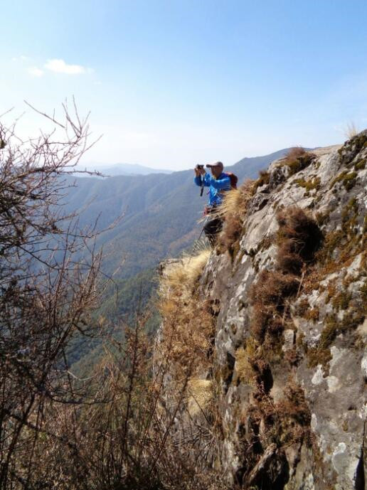
They are too fat, so they have to do it one at a time, haha!
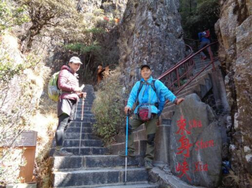
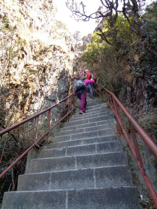
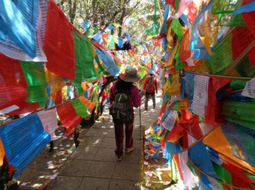
We are about to arrive at the golden submmit as the prayer flags can be found all along the way, which made us unable to see the scenery in distance.
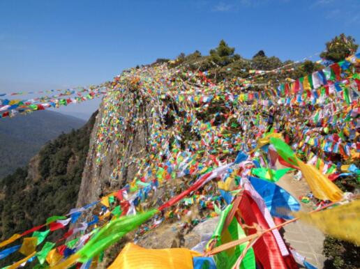
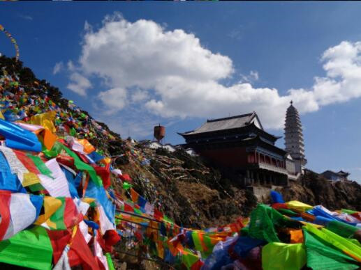
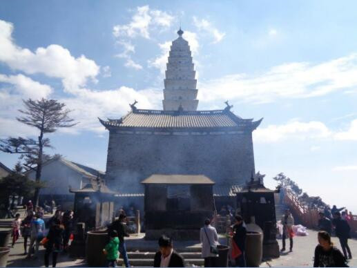
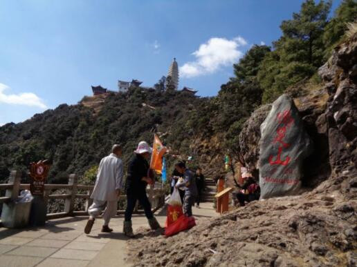
The golden submmit of Jizu Mountain (鸡足山), with the approximate altitude of 3,200 meters. Although it’s not long after the Spring Festival, we can still feel that the joss sticks and candles are burning very strong. Imagine coming here in the Spring Festival!
We reached at the top of Jizu Mountain (鸡足山) and stayed at the inn there for the marvellous sunrise the next morning.
Huh, the Sun-Chasing Golden Chicken?
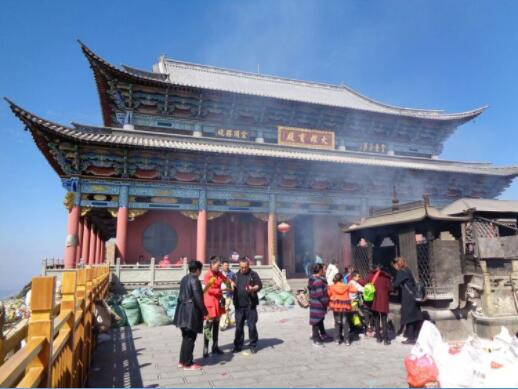
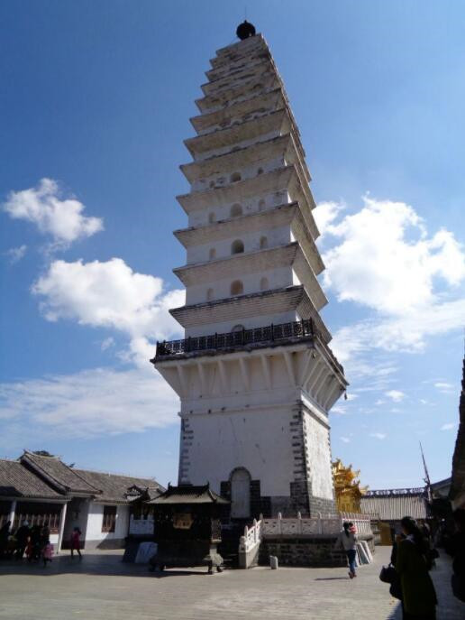
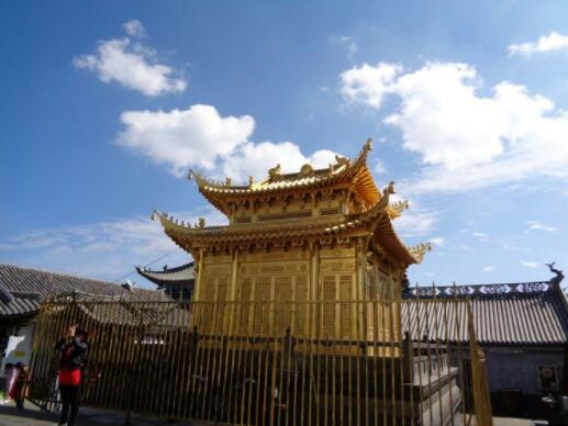
We started to climb down the hill after arriving at the observation platform.
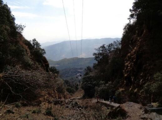
Beneath the cableway
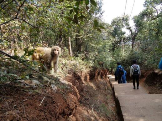
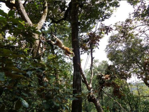
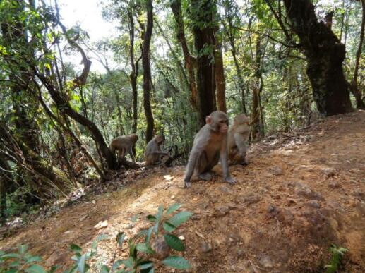
Saw this when climbing the hill, lots of them.
Monkeies who don’t afraid of people. We got along as we saw nobody hurt them.
Inside the ancient tree.
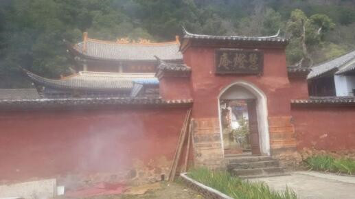
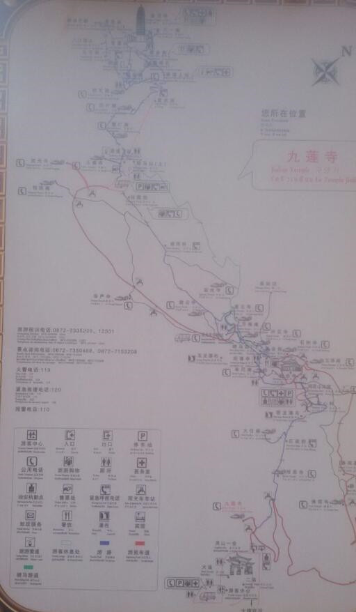
Tourist Map of Jizu Mountain
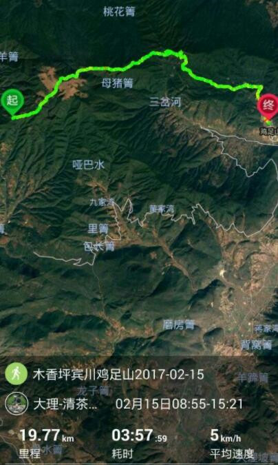
Today’s track, walked nearly 20 kilometers apart from car ride on both ends.
Usually we will arrange one night stay in Golden Submmit of Jizu Mountain and enjoy the sunrise view in the second morning. If you take one full day tour, it should be like this:
The hiking started from Caihong Forestry Station(彩虹林业站) at 9 o’clock, and we reached Jizu Mountain (鸡足山) at 1520 hours. The whole journey from Muxiangping (木香坪) to Jizu Mountain (鸡足山) took about 6.5 hours. The distance between golden top and Jizu Mountain Town (鸡足山镇) is 10.5 kilometers, which took us 5 hours to finish! You may also choose the cable car to go downhill. Thanks for your accompany, my tour pals!
More Information:
http://bbs.8264.com/thread-796040-1-1.html
https://www.meipian.cn/ddp624z?from=qzone
1.html
https://www.douban.com/group/topic/73052917/
http://bbs.zol.com.cn/dcbbs/d752_60808.html

 7 Days GolfingTour
 8 Days Group Tour
 8 Days Yunnan Tour
 7 Days Shangri La Hiking
 11 Days Yunnan Tour
 6 Days Yuanyang Terraces
 11 Days Yunnan Tour
 8 Days South Yunnan
 7 Days Tea Tour
 8 Days Muslim Tour
 12 Days Self-Driving
 4 Days Haba Climbing
 Tiger Leaping Gorge
 Stone Forest
 Yunnan-Tibet
 Hani Rice Terraces
 Kunming
 Lijiang
 Shangri-la
 Dali
Dali
 XishuangBanna
 Honghe
 Kunming
 Lijiang
 Shangri-la
 Yuanyang Rice Terraces
 Nujiang
 XishuangBanna
 Spring City Golf
 Snow Mountain Golf
 Stone Mountain Golf


