 7 Days GolfingTour
 8 Days Group Tour
 8 Days Yunnan Tour
 7 Days Shangri La Hiking
 11 Days Yunnan Tour
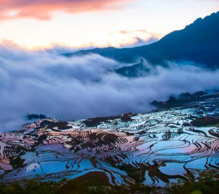 6 Days Yuanyang Terraces
 11 Days Yunnan Tour
 8 Days South Yunnan
 7 Days Tea Tour
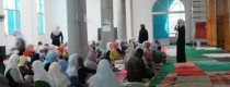
 8 Days Muslim Tour
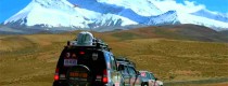
 12 Days Self-Driving
 4 Days Haba Climbing
 Tiger Leaping Gorge
 Stone Forest
 Yunnan-Tibet
 Hani Rice Terraces
 Kunming
 Lijiang
 Shangri-la
 Dali
Dali
 XishuangBanna
 Honghe
 Kunming
 Lijiang
 Shangri-la
 Yuanyang Rice Terraces
 Nujiang
 XishuangBanna
 Spring City Golf
 Snow Mountain Golf
 Stone Mountain Golf
Langyashan Mountain in Tengchong City, Baoshan
Chinese Name:腾冲市猴桥琅琊山/狼牙山
English Name: Langyashan Mountain in Tengchong County, Baoshan
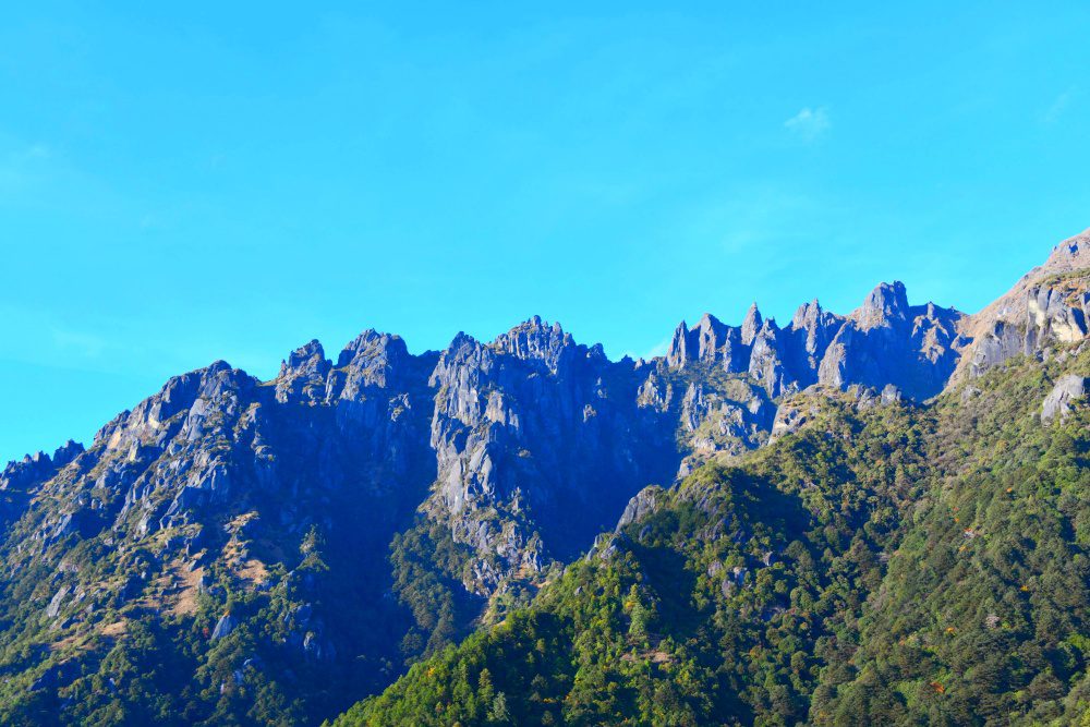
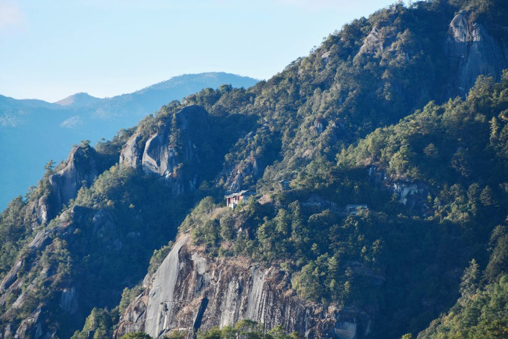
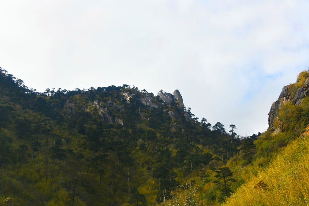
Langyashan Mountain (狼牙山), also known as Langya Mountain (琅琊山), is one of the four famous mountains in Tengchong (腾冲). Located in the northwestern part of Tengchong, in the Dianpan Township (滇滩镇), Langyashan stands as a prominent landmark on the border of Yunnan Province (云南省) and Myanmar (缅甸). The mountain is named for its striking peaks, which resemble wolf’s teeth, and is known for its dramatic landscape and rich biodiversity.
Langyashan features both towering granite peaks and a range of unique natural formations, making it a popular destination for hiking and nature lovers.
Geographical Location and Features
Location and Elevation
-
Location: The mountain is situated in the northwest of Tengchong, approximately 92 kilometers from the city center and 40 kilometers from Monkey Bridge Town (猴桥镇). To the north, it borders Myanmar.
-
Highest Peak: The peak of Nantianmen (南天门) reaches an elevation of 3,741.4 meters, making it the second-highest peak in Baoshan (保山市), just 39 meters lower than the highest peak of Gaoligong Mountain (高黎贡山).
Mountain Range
Langyashan is part of a larger mountain range that includes:
-
Langyashan Peak (狼牙山)
-
Langyashan Tou (狼牙山头)
-
Qingcao Ridge (青草岭)
-
Jifei Riverhead Mountain (鸡飞河头山)
-
Shidong Mountain (石洞山)
The mountain range creates a natural border defense between China and Myanmar, adding to its historical significance.
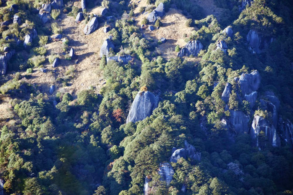
Natural Landscape and Ecological Features
Geology and Terrain
-
Langyashan has a granite peak forest landscape, characterized by rugged rocks that form spectacular shapes, resembling a giant eagle fighting for food when shrouded in mist.
-
The mountain is part of a geological barrier formed by the collision of the Eurasian Plate and the Indian Plate, which gives rise to its unique topography.
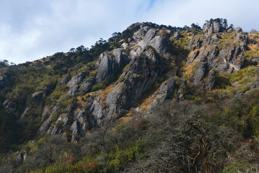
Flora and Fauna
-
Langyashan is known for its rich biodiversity, earning the title of the “Natural Gene Pool of Fauna and Flora” in northern Tengchong.
-
The area is home to rare plants such as rhododendrons (杜鹃花), bamboo forests, yellow essence (黄精), and snow mountain aconite (雪山乌头).
-
The region also supports various species of wildlife, making it a significant site for ecological research and nature tourism.
![]()
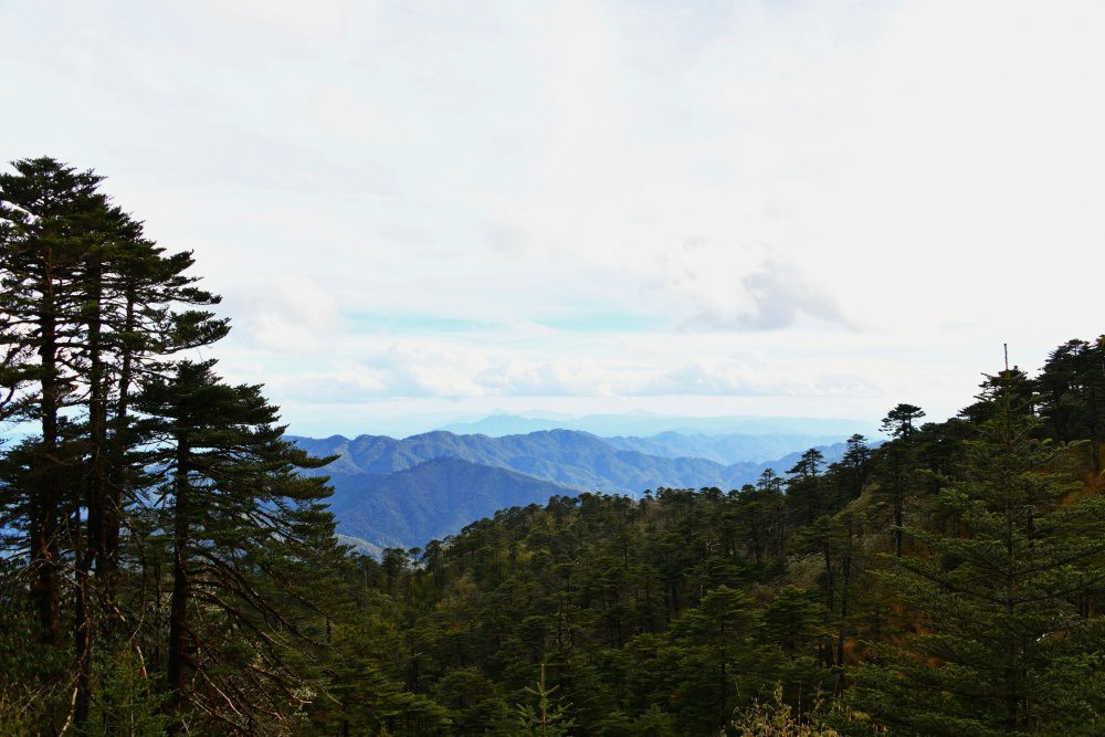
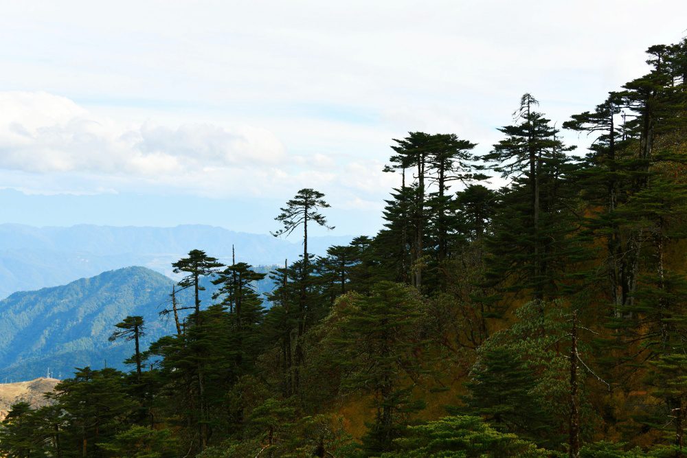
Hiking and Touring Guide
Best Time to Visit
-
Spring (March to May): Ideal for seeing rhododendrons bloom.
-
Autumn (September to November): Best for experiencing the cloud and mist seasons, which add a mystical ambiance to the mountain.
Hiking Route
-
Starting Point: Danza Village (胆扎村)
-
Main Route: Danza Village → Langyashi Temple → Nantianmen Peak
-
Duration: Approx. 8 hours round trip.
Recommended Equipment
-
Non-slip hiking shoes
-
Windproof jacket (冲锋衣)
-
Hiking poles (登山杖)
Important Notes
-
Some sections of the hiking trail require the use of both hands and feet, so it’s advisable to hire a local guide.
-
Ensure you’re physically prepared for the terrain, which can be challenging in certain areas.
![]()
Practical Information
Transportation
-
By Car: You can drive to Danza Community (胆扎社区) in Monkey Bridge Township, which takes approximately 2 hours from Tengchong.
-
By Public Transport: Take a bus from Tengchong Bus Station to Monkey Bridge Town and then transfer to a local vehicle.
Accommodation and Dining
-
Accommodation: Danza Village offers farmstay accommodations (20-30 RMB per night).
-
Dining: Try local delicacies such as wild vegetables and bamboo tube rice (竹筒饭), which are specialties of the region.


