
Laoyeshan Mountain in Yiliang County, Kunming
Overview
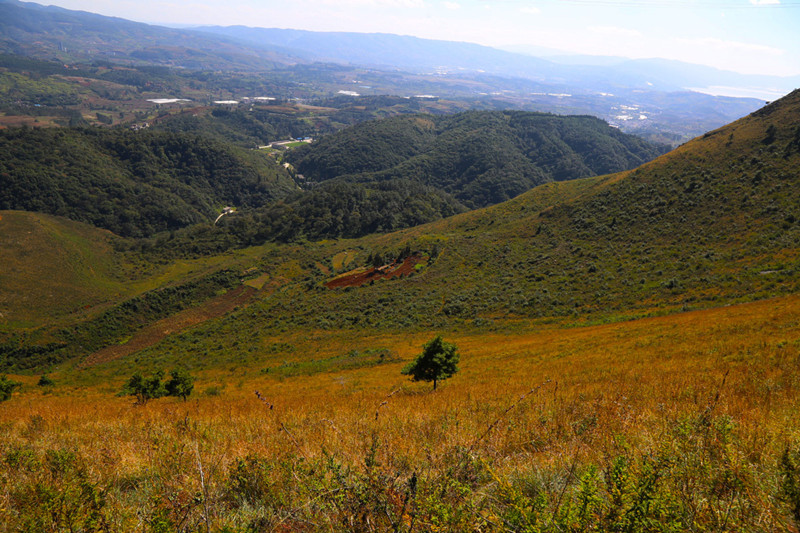
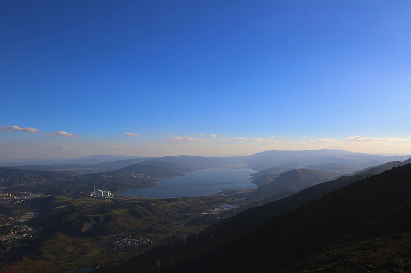
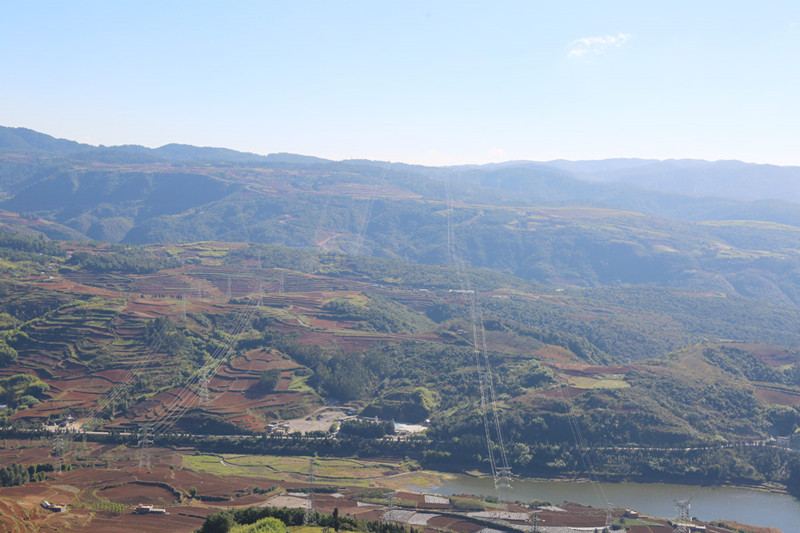
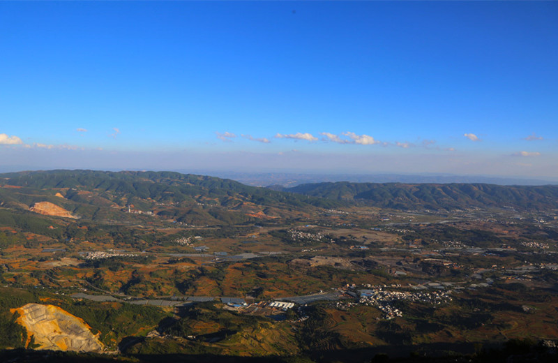
Laoyeshan Mountain (老爷山) is recognized as one of the Ten Steepest Mountains in Kunming, located between Yiliang County (宜良县) and Guandu District (官渡区) of Kunming. The mountain features a verdant landscape on its eastern side, while the upper parts are extremely steep. From the summit, visitors can enjoy breathtaking views of Yangzong Lake (阳宗海) and the Yiliang Basin (宜良盆地). A local temple fair is held on the 15th day of the sixth lunar month, attracting villagers from surrounding communities.
- Highest Altitude: 2,730 meters
- Duration: One day
- Trekking Mileage: 9 km
- Route: Kunming-Muxi Village (昆明-木希村, Tangchi Town, Yiliang County) and Kunming-Adi Village (昆明-阿底村, Dababqiao Town, Guandu District)
Mountain Details
Laoyeshan, originally named Wuna Mountain (乌纳山), stands as the highest peak in the region with an altitude of 2,730 meters. It is located north of Tangchi Town, where Yangzong Lake can be found.
- Geographical Location: Yiliang County (宜良县) and Guandu District (官渡区), Kunming, Yunnan Province (云南省昆明市)
- Area: 66 km²
- Mountain Characteristics:
- Laoyeshan has a northeast-southwest orientation, stretching approximately 22 km in length and 3 km in width. The area spans 66 square kilometers. The mountain comprises ancient Paleozoic Permian basalt and limestone. With an average altitude above 2,400 meters, there are 19 peaks surrounding the main summit. The elevation difference in the southeast is about 930 to 950 meters, classifying it as a dissected mid-mountain landscape.
Climbing Route
The climbing route begins from Muxi Village and leads to Xihua Temple (西华寺). The left path is a stair-like ascent, while the right path descends via a small road alongside Xihua Temple, featuring mountain springs and caves. After exiting the forest, both paths converge. The latter section involves rocky trails with a gradual incline. At the summit, there is a stone tablet, and on either side of the platform are two peaks: to the left is Laoyeshan, featuring the Cihang Pudu Temple (慈航普度庙) and a monument established by the Yiliang County Mountain Climbing and Camping Association. To the right lies Laoyu Mountain (老禺山), with a temple and several merit tablets. The height difference between the two peaks is minimal.
The round trip generally takes about 3 to 4 hours.
Local Cuisine and Culture
- Temple Fair: Celebrated on the 13th day of the sixth lunar month, this local temple fair, organized by villagers, is also known as the Earth Lord Temple Fair (土主庙会).
- Intangible Cultural Heritage: Yiliang Roast Duck (宜良烤鸭) and Tangchi Pickles (汤池酱菜).
Time, Cost, and Considerations
- From Chenggong (呈贡) to Tangchi (汤池): approximately 45 kilometers, 2 hours, cost around 11 yuan per person.
- From Tangchi to Muxi Village: northward for 7 kilometers, using a motorcycle taxi or van for about 2 yuan per person.
Additional Information
- Approximately 6 kilometers north of Yangzong Lake lies Laoyeshan, which is the highest peak at 2,730 meters, while the western slopes comprise the Wuna Mountain range.
- The area has a rich history of over 800 years of local worship, with the Earth Lord deity believed to be embodied by a giant stone resembling a horse’s head, bestowing blessings upon the faithful.
How to Get There
To reach Laoyeshan, take public transportation or drive from Kunming to Tangchi Town. From there, continue to Muxi Village by motorcycle taxi or van.
Travel Tips
- Wear sturdy shoes suitable for hiking, as the trails can be steep and rocky.
- Plan your visit for early morning to enjoy cooler temperatures and fewer crowds.
- Bring snacks and water, as amenities may be limited in the mountainous area.
- Respect local customs, especially during the temple fair, to fully experience the cultural heritage of the region.

 7 Days GolfingTour
 8 Days Group Tour
 8 Days Yunnan Tour
 7 Days Shangri La Hiking
 11 Days Yunnan Tour
 6 Days Yuanyang Terraces
 11 Days Yunnan Tour
 8 Days South Yunnan
 7 Days Tea Tour
 8 Days Muslim Tour
 12 Days Self-Driving
 4 Days Haba Climbing
 Tiger Leaping Gorge
 Stone Forest
 Yunnan-Tibet
 Hani Rice Terraces
 Kunming
 Lijiang
 Shangri-la
 Dali
Dali
 XishuangBanna
 Honghe
 Kunming
 Lijiang
 Shangri-la
 Yuanyang Rice Terraces
 Nujiang
 XishuangBanna
 Spring City Golf
 Snow Mountain Golf
 Stone Mountain Golf


