 7 Days GolfingTour
 8 Days Group Tour
 8 Days Yunnan Tour
 7 Days Shangri La Hiking
 11 Days Yunnan Tour
 6 Days Yuanyang Terraces
 11 Days Yunnan Tour
 8 Days South Yunnan
 7 Days Tea Tour
 8 Days Muslim Tour
 12 Days Self-Driving
 4 Days Haba Climbing
 Tiger Leaping Gorge
 Stone Forest
 Yunnan-Tibet
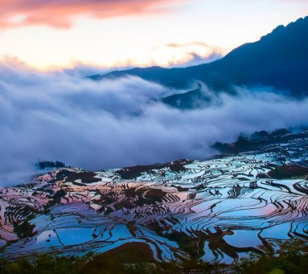
 Hani Rice Terraces
 Kunming
 Lijiang
 Shangri-la
 Dali
Dali
 XishuangBanna
 Honghe
 Kunming
 Lijiang
 Shangri-la
 Yuanyang Rice Terraces
 Nujiang
 XishuangBanna
 Spring City Golf
 Snow Mountain Golf
 Stone Mountain Golf


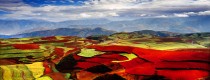

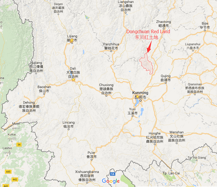
Location Map of Dongchuan District in Yunnan
Geographic Coordinates
Dongchuan District is located in the northeastern part of Yunnan Province, at the northernmost edge of Kunming City. The geographic coordinates of Dongchuan are approximately:
- Latitude: 26°00′ N
- Longitude: 103°00′ E
Surrounding Regions
Dongchuan District is bordered by the following areas:
- East: Huize County (会泽县), Qujing City, Yunnan.
- South: Xundian County (寻甸县), Kunming City.
- West: Luqiao County (禄劝县), Kunming City.
- North: Qiaojia County (巧家县), Zhaotong City, Yunnan.
- To the north, across the Jinsha River, it faces Huili City and Huiedong County in Liangshan Prefecture, Sichuan Province.
Geographical Features
Dongchuan is situated on the northern edge of the Yunnan-Guizhou Plateau. It has a highly varied topography, with an elevation difference of 3,649.1 meters:
- The highest point is 4,344.1 meters above sea level.
- The lowest point is 695 meters above sea level.
This elevation difference contributes to Dongchuan’s unique natural landscapes and climatic conditions, which make it an interesting destination for travelers and nature enthusiasts.


