7 Days GolfingTour
 8 Days Group Tour
 8 Days Yunnan Tour
 7 Days Shangri La Hiking
 11 Days Yunnan Tour
 6 Days Yuanyang Terraces
 11 Days Yunnan Tour
 8 Days South Yunnan
 7 Days Tea Tour
 8 Days Muslim Tour
 12 Days Self-Driving
 4 Days Haba Climbing
 Tiger Leaping Gorge
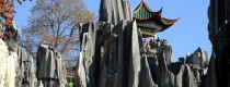
 Stone Forest
 Yunnan-Tibet
 Hani Rice Terraces
 Kunming
 Lijiang
 Shangri-la
 Dali
Dali
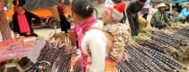
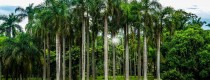
 XishuangBanna
 Honghe
 Kunming
 Lijiang
 Shangri-la
 Yuanyang Rice Terraces
 Nujiang
 XishuangBanna
 Spring City Golf
 Snow Mountain Golf
 Stone Mountain Golf
Location Map of of Yuanyang Hani Rice Terraces in Yunnan
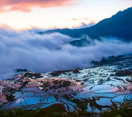
The Yuanyang Hani Rice Terraces (元阳梯田) are located in the southern part of the Ailao Mountains (哀牢山) in Yuanyang County (元阳县), Honghe Hani and Yi Autonomous Prefecture (红河哈尼族彝族自治州), Yunnan Province (云南省). These terraces are a remarkable agricultural civilization wonder jointly created by the Hani people (哈尼族) and other ethnic groups under special geographic and climatic conditions. The total area of the terraces is approximately 1 million acres (约100万亩).
Geographic Location
The specific location of the Yuanyang Hani Rice Terraces (元阳梯田) is in Qingkou Village (箐口村), Xinjie Town (新街镇), within Yuanyang County (元阳县), situated in the southern part of the Ailao Mountains (哀牢山). Yuanyang County (元阳县) is located between 115°52′—116°8′ E and 29°26′—29°41′ N, covering an area approximately 25 kilometers in length and 10 kilometers in width. The highest peak in the area is Hanyang Peak (汉阳峰), with an elevation of 1,474 meters.
Geographical Features
The terrain of the Yuanyang Hani Rice Terraces (元阳梯田) mainly includes plateau terrain with significant undulations. The contour lines are highly curved and dense, indicating a substantial variation in elevation. The rice terraces adapt to the changes in the mountainous terrain, with larger terraces cultivated in flatter areas and smaller terraces in steeper areas. Even small gaps along the riverbanks or rocky crevices are utilized for terracing. As a result, the terraces vary in size, with some covering several acres, while others are as small as a handful of rice husks.