 7 Days GolfingTour
 8 Days Group Tour
 8 Days Yunnan Tour
 7 Days Shangri La Hiking
 11 Days Yunnan Tour
 6 Days Yuanyang Terraces
 11 Days Yunnan Tour
 8 Days South Yunnan
 7 Days Tea Tour
 8 Days Muslim Tour
 12 Days Self-Driving
 4 Days Haba Climbing
 Tiger Leaping Gorge
 Stone Forest
 Yunnan-Tibet
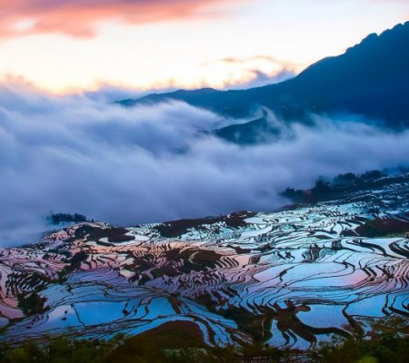
 Hani Rice Terraces
 Kunming
 Lijiang
 Shangri-la
 Dali
Dali
 XishuangBanna
 Honghe
 Kunming
 Lijiang
 Shangri-la
 Yuanyang Rice Terraces
 Nujiang
 XishuangBanna
 Spring City Golf
 Snow Mountain Golf
 Stone Mountain Golf


Location Map of Yingjiang County in Yunnan
Yingjiang County (盈江县) is located in the northwestern part of Dehong Dai and Jingpo Autonomous Prefecture in Yunnan Province. It lies at the intersection of China and Myanmar.
Geographic Coordinates:
- Longitude: 97°31′ E to 98°16′ E
- Latitude: 24°24′ N to 25°20′ N
Surrounding Areas:
- Northeast: Borders Tengchong City.
- Southeast: Borders Lianghe County.
- South: Borders Longchuan County.
- West, Northwest, and Southwest: Borders Myanmar.
Yingjiang County is located 153 kilometers from Mangshi (the capital of Dehong Prefecture), 735 kilometers from Kunming, 197 kilometers from Myitkyina (Myanmar), and 131 kilometers from Bhamo (Myanmar).
Geographical Features:
- The terrain of Yingjiang is higher in the northeast and lower in the southwest.
- It belongs to the South Asian tropical monsoon climate, with an average annual temperature of 19.3°C.
- The county has 32 major routes crossing a 214.6-kilometer border with Myanmar’s Kachin State, making it a strategic gateway connecting South Asia, Southeast Asia, and the Indian Subcontinent.
Yingjiang is a key border area, serving as a golden passageway for trade and cultural exchange between China and Myanmar.


