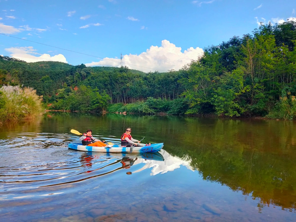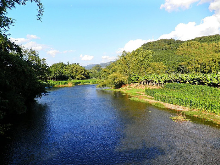
Nanla River in Mengla County, Xishuangbanna
Chinese Name:南腊河
English Name: Nanla River in Mengla County, XishuangBanna
The Naluo River (meaning “river of tea water” in Dai language), located in Mengla County, Yunnan Province, People’s Republic of China, is the final tributary of the Lancang River (Mekong River) before it flows into its main stem within Chinese territory. Its main source, the Nandao River, originates from the hinterland of Daqingshuzhai, Jinchang River Village, Mengban Town, eastern Mengla County. It flows northwest to southwest through Mengban Town, Wanguan Tree Scenic Area, and Mengla County town, then turns west near Manmai in the southwest of the county to join the Nanmuwo River, flowing northwest to north at Manpeng Village, Mengpeng Town, and westward at Mangang Village, Guanlei Town, finally converging with the Lancang River at the junction of China, Myanmar, and Laos, known as the tri-border area.
The river has a total length of 186.8 kilometers, with a drop of 850 meters, an average channel slope of 1.8‰, and a basin area of 4570 square kilometers (3911 square kilometers within China). The climate in the Naluo River basin is hot with high humidity, averaging an annual temperature of 21°C and annual precipitation of 1550 millimeters. The basin is rich in forest resources, with a forest coverage rate of 73.2%. The Mengla and Shangyong areas of the Xishuangbanna National Nature Reserve are located within the basin. The area is inhabited mainly by ethnic minorities such as Dai, Hani, Yao, and Yi. Rubber planting is the dominant economic activity, making it a major region for natural rubber production in Yunnan.
The Nanla River, part of the Lancang River system, stretches approximately 186 kilometers and is the final primary tributary of the Lancang River before it exits China. The river meanders through a rugged landscape with numerous tributaries, including the Nansha River and Nangang River. Due to its hot and humid climate with abundant rainfall, dense forests cover the entire Nanla River basin, with some of its tributaries yet to be fully explored.
The Nanla River, renowned for its beautiful legends, flows through the Wantianshu Tropical Rainforest Theme Park in Xishuangbanna. The riverside rainforest scenery is exquisite, filled with the clear calls of birds. The river hosts over a hundred species of fish, including the rare and precious “Peach Blossom Jellyfish” surviving in its waters.
Originating between Xiangguntang Mountain in Mengla County and Daqingshuliangzi, the river basin spans the southeastern part of Mengla County. It is the largest river within Mengla County and a primary tributary of the Lancang River system. The main channel passes through administrative towns such as Mengban, Yaoqu, Mengla, Shangyong, Mengpeng, and Guanlei. Flowing from northeast to south, the river turns west at Mengpeng Town, joining the Lancang River at the border tri-junction of China, Laos, and Myanmar at Guanlei. With a total length of 186 kilometers, the river is 30 meters wide with a drainage area of 4563 square kilometers. The natural drop in elevation along its course is 1065 meters, averaging a slope of 4.03%. The average annual water flow is 22.27 billion cubic meters, making it a vital irrigation source for Mengla County.
Geographically, the Nanla River basin lies east of the Lancang River Fault, characterized by varied terrain ranging from the highest point at Leigongyan with an elevation of 2008 meters in the north, to the confluence with the Lancang River at an elevation of 477 meters in the west. This extreme elevation difference spans 1531 meters.
The Nanla River is a magical place with elegant bamboo houses, beautiful phyllostachys, Dai girls in colorful tube skirts, temples, pagodas, elephants, peacocks, Wantianshu trees, dancing grass, Zhangha songs, and elephant-foot dances, all set against a backdrop of rainforest, encompassing all the wonders of Xishuangbanna!

 7 Days GolfingTour
 8 Days Group Tour
 8 Days Yunnan Tour
 7 Days Shangri La Hiking
 11 Days Yunnan Tour
 6 Days Yuanyang Terraces
 11 Days Yunnan Tour
 8 Days South Yunnan
 7 Days Tea Tour
 8 Days Muslim Tour
 12 Days Self-Driving
 4 Days Haba Climbing
 Tiger Leaping Gorge
 Stone Forest
 Yunnan-Tibet
 Hani Rice Terraces
 Kunming
 Lijiang
 Shangri-la
 Dali
Dali
 XishuangBanna
 Honghe
 Kunming
 Lijiang
 Shangri-la
 Yuanyang Rice Terraces
 Nujiang
 XishuangBanna
 Spring City Golf
 Snow Mountain Golf
 Stone Mountain Golf


