
Yangzonghai Lake in Yiliang County, Kunming
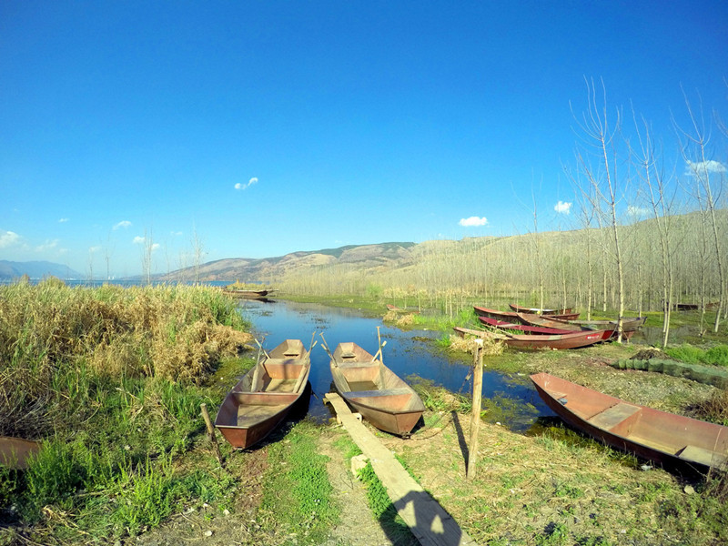
Yangzonghai Lake (阳宗海) is one of the nine major plateau lakes in Yunnan, spanning the borders of Chengjiang (澄江), Chenggong (呈贡), and Yiliang (宜良) counties. It is located between longitudes 102°5′ and 103°02′, and latitudes 24°51′ to 24°58′, approximately 36 kilometers from Kunming (昆明), and belongs to the Nanpan River (南盘江) system of the Pearl River (珠江) basin.
Historical Background
Originally known as Daze (大泽) or Yixiu Lake (奕休湖), it was referred to as Ming Lake (明湖) during the Ming Dynasty (明朝). The name Yangzonghai comes from its proximity to the residence of the local officials. This lake is classified as a young lake formed later in geological history and is characterized as a tectonic fault lake, known for its abundant catches of golden-line fish (金线鱼). The primary water sources for the lake include the surrounding Tangquan River (汤泉河) and rainfall.
Geographical Features
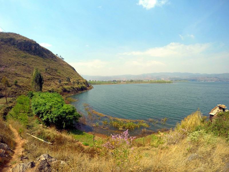
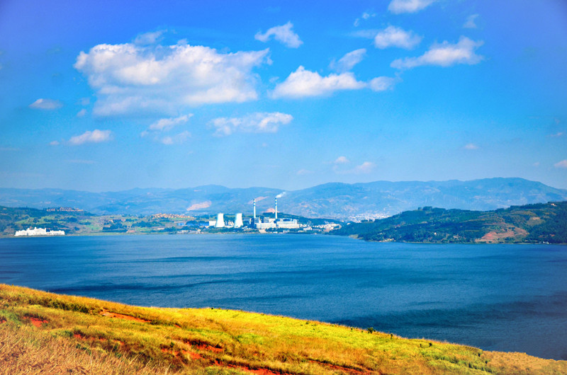
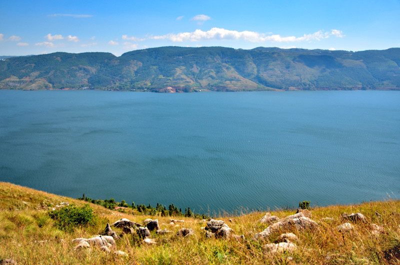
Yangzonghai Lake has a spindle shape, with its long axis oriented north-south. The watershed area is 252.7 square kilometers, while the lake surface area is 31.1 square kilometers. The water level reaches an elevation of 1770.46 meters, with an average depth of 20 meters and a total water storage capacity of 604 million cubic meters. Major inflows include the Yangzong River (阳宗大河), Shizhai River (石寨河), and Qixing River (七星河), with Tangchi Channel (汤池渠) as the only outlet. The eastern and western shores of the lake are steep, while cultivated fields are distributed on the northern and southern sides.
Name Origin
According to historical records, the name Yangzonghai is derived from the strong Zong (宗) tribe that settled in the area during the Nanzhao Dali Kingdom (南诏大理国) period, where it was classified as a stronghold. In the fourth year of the Baoyou period (1256 AD), a local government was established in this region. The name later evolved from “Qiangzong” to “Yangzong,” hence the name Yangzonghai. During the Yuan Dynasty (元代), the lake was referred to as “Da Chi” (大池) because of the hot springs (温泉) nearby, leading to its alternate name, Tangchi (汤池).
Formation and Evolution
Yangzonghai Lake is a fault-structured lake located in the Xiaojiang Fault Zone (小江断裂带). It was formed due to the intense development of surface fractures, creating a graben-type tectonic lake. Over time, this basin developed into the structural lake we see today.
Location and Boundary
Yangzonghai Lake is located between longitudes 102°5′ and 103°02′ and latitudes 24°51′ to 24°58′, just 36 kilometers from Kunming. The 326 National Highway (即昆河公路) runs through the area, making it easily accessible. The lake’s surface is spindle-shaped, wider at both ends and slightly narrower in the middle, with an elevation of 1770 meters. It stretches approximately 12 kilometers from north to south and about 3 kilometers from east to west, covering an area of 31.49 square kilometers. The total water storage capacity of Yangzonghai is 604 million cubic meters. The watershed area covers 192 square kilometers (upstream of the Tangchi hydrological station), with around 20 square kilometers of lake surface area within Kunming (昆明), of which Yiliang County accounts for 14 square kilometers and Chenggong District for 6 square kilometers. The shoreline of the lake is approximately 32.3 kilometers long.
Scenic Area Details
Water System Composition
The average annual water production in the Yangzonghai watershed is about 36 million cubic meters, with an additional 20 million cubic meters sourced from the Baisi River (摆衣河). The average annual water volume is around 56 million cubic meters. The average inflow to the lake is 52 million cubic meters, with an average outflow of 36 million cubic meters. The primary water sources, apart from rainfall during the rainy season, include the Yangzong River, Shizhai River, and the Baisi River.
Major Rivers in the Yangzonghai Watershed
| River Name | Area (Square Meters) | Length (Kilometers) |
|---|---|---|
| Yangzong River | 64.45 | 12.92 |
| Baisi River | 94.00 | 19.06 |
| Qixing River | 14.40 | 6.37 |
| Luxichong River | 8.18 | 5.10 |
The Yangzong River is the main natural inflow to Yangzonghai Lake, originating from two tributaries: the right tributary Mazhuang River (马庄河) and the left tributary Shizhai River. The Qixing River springs from the hillside of Yangzonghai and features a reservoir. The Baisi River does not belong to the natural drainage area of Yangzonghai but was artificially connected to the lake in 1960 through a diversion channel.
Hydrology Characteristics
The flood season in the Yangzonghai watershed occurs from May to October, accounting for approximately 86% of the annual precipitation, with June to August contributing to 57% of the total annual rainfall. The overall pattern shows abundant summer runoff, low winter flow, and transitional conditions in spring and autumn.
When the lake surface water level is at 1770.46 meters, the surface area is about 31 square kilometers, with an average depth of 20 meters and a maximum depth of 30 meters. The total shoreline measures 32.3 kilometers, and the total water storage capacity is 604 million cubic meters. Recent maximum water levels were recorded at 1770.77 meters (November 3, 1999), while the lowest level was 1767.53 meters (May 29, 1995).
Pollution Overview
The pollution in Yangzonghai is primarily characterized by domestic waste and non-point source pollution, which mainly comes from nearby towns and the cooling water from the Yangzonghai Power Plant. The nitrogen and phosphorus concentrations in the water have exceeded the limits, surpassing the threshold for eutrophication.
From 1997 to 2001, Yangzonghai experienced its most severe pollution in 1997, with pollution levels peaking. By 2001, most of the lake’s water quality improved to Category II standards. However, significant concerns remain about total phosphorus and total nitrogen levels.
According to the 2015 annual environmental report of Yunnan Province, the water quality in Yangzonghai was categorized as Class IV, indicating mild pollution and not meeting the environmental function requirements (Class II). Major exceedances were noted for arsenic, total phosphorus, and chemical oxygen demand.
Natural Resources
Fish Resources
Yangzonghai is home to 28 species of fish classified into 6 orders, 11 families, and 20 genera. Among them, 20 species are native, while 8 are non-native. Notable among the native species are the four unique to the Nanpan River system, five endemic to Yangzonghai, and five endemic to the Yunnan-Guizhou Plateau (云贵高原). The golden-line fish is the primary economic fish, making up about 70% of the fish catch. However, certain species like Yangzong Snail (阳宗螺蛳), Yangzong White Fish (阳宗白鱼), and others have gradually disappeared since the 1980s.
From 2008 to 2010, an investigation into the fish genetic resources in the Nanpan River system found five native fish species including Yangzong White Fish, crucian carp, loach, yellow eel, and black fish.
Fish Species in Yangzonghai
| Order | Family | Fish Species |
|---|---|---|
| Salmoniformes | Hypophthalmichthys | Taihu New Silver Fish |
| Cypriniformes | Cobitidae | Loach |
| Cyprinidae | Grass Carp, Bighead Carp, Silver Carp, Crucian Carp, etc. | |
| Other Families | Maimai Fish, Stickleback, Chinese Psephurus |
Yangzonghai Lake offers a rich diversity of natural resources and a picturesque landscape, making it a vital ecological region in Yunnan Province.
List of Attractions and Names
- Yangzonghai Lake (阳宗海)
- Kunming (昆明)
- Chengjiang (澄江)
- Chenggong (呈贡)
- Yiliang (宜良)
- Tangquan River (汤泉河)
- Yangzong River (阳宗大河)
- Shizhai River (石寨河)
- Qixing River (七星河)
- Tangchi Channel (汤池渠)
- Daze (大泽)
- Yixiu Lake (奕休湖)
- Ming Lake (明湖)
- Nanzhao Dali Kingdom (南诏大理国)
- Yangzong Snail (阳宗螺蛳)
- Yangzong White Fish (阳宗白鱼)
Plant Resources
In 2003, the composition of algal species in Yangzonghai Lake included 4 divisions and 13 genera, consisting of: 9 genera of Cyanophyta (蓝藻门), 2 genera of Cryptophyta (隐藻门), 2 genera of Bacillariophyta (甲藻门), 6 genera of Bacillariophyta (硅藻门), 4 genera of Euglenophyta (裸藻门), 19 genera of Chlorophyta (绿藻门), and 1 genus of Chrysophyta (金藻门). The most common species is Microcystis (小环藻). The dominant algal species are Microcystis (小环藻), Microcystis aeruginosa (微囊藻), and Oocystis (卵囊藻) in spring; Microcystis (小环藻) in summer; and Microcystis (小环藻) in winter.
Vegetation Distribution
The Yangzonghai watershed belongs to the northern subtropical vegetation zone of the Yunnan Plateau. The forest types are semi-humid evergreen broadleaf forests, coniferous forests, and mixed coniferous-broadleaf forests. Agricultural cultivation and land reclamation have severely damaged a large amount of vegetation and lakeside wetlands in the watershed. The successive establishment of industrial enterprises and recreational facilities lacks unified planning, resulting in outdated environmental protection facilities and incomplete biological management measures. Consequently, soil erosion in the watershed has reached 65%, with annual soil and water loss amounting to 236,000 tons, leading to a deteriorating ecological environment.
The secondary biological species growing in the Yangzonghai watershed include a mixed forest composed of Yunnan pine (云南松), Huashan pine (华山松), Yunnan fir (云南油杉), drought-resistant East melon (旱东瓜), eucalyptus (桉树), cypress (柏树), poplar (杨树), and oak (栎类) broadleaf trees. The shrub forest mainly consists of dominant species such as spiny acacia (苦刺), thorn pear (棠梨), small iron (小铁子), and other plants. The artificial economic forests primarily include walnuts (核桃), peaches (桃子), pears (梨), and chestnuts (板栗). The vegetation in the entire watershed has transitioned from a composite type to a single type, with forest environments degrading into barren types. In 2004, the forest coverage (including wooded and shrub areas) in the Yangzonghai watershed was 23.67%. Among this, the coverage of wooded land was 13.62%, and the coverage of shrub land was 10.05%. The overall vegetation coverage (including cultivated land, forested land, and grassland) in the Yangzonghai watershed was 77.38%, with cultivated land covering 35.67%, forested land covering 23.67%, and grassland covering 18.04%.
Land Overview (土地概况)
The Yangzonghai watershed includes areas from Qidian Township (七甸乡) in Chenggong County (呈贡县), Yangzong Town (阳宗镇) in Chengjiang County (澄江县), and Tangchi Town (汤池镇) and Caodian Township (草甸乡) in Yiliang County (宜良县). From 1995 to 2004, cultivated land area decreased by 11.05%, with paddy fields decreasing by 6.0%, dry land decreasing by 12.7%, and forested area decreasing by 8.58%, among which the area of wooded land increased by 57.73%, while shrub land decreased by 23.66%. Grassland decreased by 3.60%, and the water area slightly increased by 0.50%. The area of residential, industrial, and transportation land increased by 101.63%. The main agricultural activities in the watershed primarily focus on the cultivation of grains and vegetables, with fruit cultivation being secondary.
Topography and Landform (地形地貌)
About 6 kilometers north of Yangzonghai is the main peak of the Wuna Mountain Range (乌纳山脉), Lao Ye Mountain (老爷山), which has an elevation of 2,730 meters and is the highest peak in Yiliang County (宜良县). The western shore features the Wuna Mountain’s foothills. The northernmost peak, Xiangyang Mountain (向阳山), has an elevation of 2,523.4 meters, while the southern peak, Matou Mountain (马头山), is 2,242 meters high. The elevation of Pingpo Head (平坡头) is 1,991 meters, and Guanshan Mountain (官山) is 1,885 meters high. The eastern shore features the Yinxian Bottom (迎仙底) at an elevation of 1,874 meters, with Huazhulong Southwest Peak (花树龙西南峰) at 1,994 meters, Black Dragon Mountain (黑龙山) at 2,111 meters, Dagezi (大凹子) at 2,184 meters, Heijizhuangzi (黑脊梁子) at 2,268.1 meters, and Tang Lao Ye Grave (塘老爷坟) at 2,407.8 meters. The southern Yangzong Basin (阳宗坝子) slopes northward, with all water flowing toward Yangzonghai. To the north, behind Tangchi Basin (汤池坝子) and Zouma Ping (走马坪), Lao Hong Mountain (老红山) has an elevation of 1,890.2 meters, and Jiangjia Mountain (姜家山) is 1,967 meters high. The Kunhe Railway (昆河铁路) passes behind Lao Hong Mountain and Jiangjia Mountain.
Lakeside Landscape
Beach Amusement Park
Yangzonghai Beach Amusement Park (阳宗海海滨游乐场) is the first emerging tourist attraction opened to the public in Yunnan’s first provincial-level tourism resort. This amusement park is a large-scale comprehensive recreational area centered around water amusement projects, covering an area of 140,000 square meters, with over 40 land, water, and air amusement projects. The water surface covers 11.5 square kilometers, and the lawn area is 60,000 square meters.
There are more than 40 water, land, and air amusement projects, including seaplanes (水上飞机), water parachuting (水上跳伞), jet skiing (摩托艇), beach volleyball (沙滩排球), and more. The park has also constructed open-air barbecue areas, business leisure areas, and lush gardens. In the park, visitors can enjoy beautiful scenery, participate in thrilling water sports, and appreciate the environment along the lakeside.
Yangzonghai Water Sports Center (阳宗海水上运动中心)
The Yangzonghai Water Sports Center is a professional water sports facility that offers various water activities, including windsurfing, kayaking, rowing, and pedal boating. The center provides complete services, including boat rental, training, and water sports equipment sales. The center has become a popular destination for water sports enthusiasts and tourists looking to engage in exciting activities on the lake.


 7 Days GolfingTour
 8 Days Group Tour
 8 Days Yunnan Tour
 7 Days Shangri La Hiking
 11 Days Yunnan Tour
 6 Days Yuanyang Terraces
 11 Days Yunnan Tour
 8 Days South Yunnan
 7 Days Tea Tour
 8 Days Muslim Tour
 12 Days Self-Driving
 4 Days Haba Climbing
 Tiger Leaping Gorge
 Stone Forest
 Yunnan-Tibet
 Hani Rice Terraces
 Kunming
 Lijiang
 Shangri-la
 Dali
Dali
 XishuangBanna
 Honghe
 Kunming
 Lijiang
 Shangri-la
 Yuanyang Rice Terraces
 Nujiang
 XishuangBanna
 Spring City Golf
 Snow Mountain Golf
 Stone Mountain Golf


