 7 Days GolfingTour
 8 Days Group Tour
 8 Days Yunnan Tour
 7 Days Shangri La Hiking
 11 Days Yunnan Tour
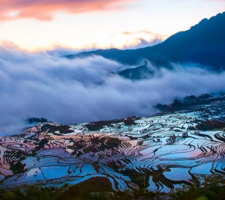 6 Days Yuanyang Terraces
 11 Days Yunnan Tour
 8 Days South Yunnan
 7 Days Tea Tour
 8 Days Muslim Tour
 12 Days Self-Driving
 4 Days Haba Climbing
 Tiger Leaping Gorge
 Stone Forest
 Yunnan-Tibet
 Hani Rice Terraces
 Kunming
 Lijiang
 Shangri-la
 Dali
Dali
 XishuangBanna
 Honghe
 Kunming
 Lijiang
 Shangri-la
 Yuanyang Rice Terraces
 Nujiang
 XishuangBanna
 Spring City Golf
 Snow Mountain Golf
 Stone Mountain Golf
Bing-Cha-Cha Road from Bingzhongluo to Chawalong between Yunnan and Tibet
It is the eastern section of Bing-cha-ran highway(丙察然公路) , connecting Bing zhongluo Village(丙中洛乡)(Gongshan county of Yunnan province云南省贡山县)- Cha Walong Village(察瓦龙乡)(Cha Yu county of Tibet Autonomous region 西藏察隅县)- Cha Yu Town(察隅县城), with a total length of 270 kilometers. As a humble and dangerous road was built in 2009. Due to the construction of New Yunnan-Tibet highway, it was soon upgraded to a level- 3 asphalted highway (with an investment of 1.8 billion CNY ), which was absolutely the most difficult section to be reconstructed.
It is a game for brave, there is no sign on the map. Bing-cha-cha is (丙察察)the shortest but the most precipitous way into Tibet(西藏), so far only a handful of people have been there! Domestic travelers named Bin-Cha-Cha(丙察察)because it is from Bing Zhongluo Village(丙中洛乡)(Gongshan county of Yunnan province)to ChaYu Town(察隅县)(Tibet Autonomous region西藏) .It is known as the seventh highway and also the most difficult route to Tibet(西藏). At the same time, it allows you to experience the ultimate feeling between heaven and hell because of the most primitive and beautiful scenery.
Some people think that when entering to Tibet(西藏) from line 318 Sichuan-Tibet highway(川藏线), visitors’ bodies are in hell while their eyes are in heaven enjoying big feasts. For Bing -Cha-cha road(丙察察公路), it is the hell within hell and the heaven within heaven.
Bing Cha line(丙察线) is one of the routes to Tibet(西藏) in western Yunnan(云南). The whole journey is over 270 kilometers, which can be reached within two days according to the normal mileage. It is the most convenient way to enter Tibet(西藏) presently.
The annual opening time of Bing-cha-cha (丙察察)is May to October, and the rest of the time could not be passed due to the snowbound mountainous . It is the rainy season from the end of July to September. On account of the poor road conditions that caused by landslides and mudslides, the passable time of the line is actually less than 4 months.
Bing-cha-cha(丙察察)has a high reputation in hiking, cycling and cross-country areas; It has a dense primeval forests, cliffs through the township road, the rough Nu River(怒江) etc. Also known as the holy land in cross-country fields.
This humble road connects western Yunnan(云南) and southeastern Tibet(西藏), with gravel, hollows, riprap, landslides, quicksand and falling stones throughout the entire journey . This unlikely road has attracted countless off-road enthusiasts.
The mainly reason why entitled “The most difficult route to Tibet (西藏)”is the half-cliff road conditions. Bing-cha-cha(丙察察)is the last section of the road from western Yunnan(云南) to Tibet(西藏). It is located in the western part of Yunna(云南) province. The highway is located on both sides of Nu River(怒江) for a long distance, which can be said that it is excavated on cliffs beside Nu River(怒江).
Bing-cha-cha highway (丙察察公路)conditions:
Bing-cha-cha highway(丙察察公路): It is the eastern section of Bing-cha-ran highway (丙察然公路)(which is core project of New Yunnan-Tibet highway), connecting Bing Zhongluo Village(丙中洛乡)- Cha Wa long Village(察瓦龙乡))- Cha Yu Town(察隅县), with a total length of 270 kilometers. It is included in Bing-cha highway(丙察公路) and Cha-cha line(察察线), completed in 2009. It is also known as the seventh highway route to Tibet(西藏). It is over 30 kilometers from Bingzhongluo Village(丙中洛乡) to Chawalong Village(察瓦龙乡). And Chacha highway(察察公路) or Chacha Line (察察线)dominates the road. The section of roads from Bingzhongluo(丙中洛) to Chawalong(察瓦龙)were initially constructed in 2000 and finished in 2009. The roads from Chayu County(察隅县) to Chawalong Village(察瓦龙乡)were first constructed in 2008 and eventually completed in 2011 after several reconstructions.![]()
Historical significance:
Before October 2009, Cha-cha line(察察线) had not yet been constructed , from Chayu(察隅)to Cha Walong(察瓦龙) could not be open to traffic, so that the leadership of Chayu county(察隅县) took thousands of kilometers detoured though Sichuan-Tibet line(川藏线) or Yunnan-Tibet(滇藏线) to Chawalong Village(察瓦龙乡) for inspected the work.
The 195- kilometre-long Chacha line(察察线) is from Chayu (察隅)to Chawalong (察瓦龙)involved climbing three passes of 4,500 to 4,900 metres, passing through primeval forests, mountains, meadows and riprap areas. However, in the transition zone between Yunnan-Guizhou Plateau (云贵高原)and Qinghai-Tibet Plateau(青藏高原), the general view of the Bing-cha-cha line (察察线)is relatively low elevation, some of it is about 2,000 meters, so it could be open to traffic in all seasons.
PS: Ranwu Village(然乌乡) 【Bomi county of Chayu county town(波密县察隅县城)】with a huge terrain and high elevation: From Chayu (察隅)to Ranwu(然乌) passes though Demula snow mountain(德姆拉雪山), climbing this steep mountain from 2,000 meters to 5,000 meters through Ranwu Village(然乌乡), then moves in to Sichuan-Tibet line(川藏线)(318 national road)and hurries to Bomi county(波密县). The pass of Demula snow Mountain(德姆拉雪山) is close to the pass of Ranwu Mountain(然乌山) which belongs to Charan highway(察然公路).
Bing-cha-cha line(丙察察线)is not only the most perilous route to Tibet, but also the most beautiful scenery of the original line. It seems farfetched to called highway. As a matter of fact, it is only a humble road between county and village. Rarely travellers choose this way to Tibet(西藏) because of the poor road conditions and the tough road. And these make Bing-cha-cha(丙察察) full of cryptic colouring. Among them , the most hardest road is before and after section of Chawalong(察瓦龙).![]()
