 7 Days GolfingTour
 8 Days Group Tour
 8 Days Yunnan Tour
 7 Days Shangri La Hiking
 11 Days Yunnan Tour
 6 Days Yuanyang Terraces
 11 Days Yunnan Tour
 8 Days South Yunnan
 7 Days Tea Tour
 8 Days Muslim Tour
 12 Days Self-Driving
 4 Days Haba Climbing
 Tiger Leaping Gorge
 Stone Forest
 Yunnan-Tibet
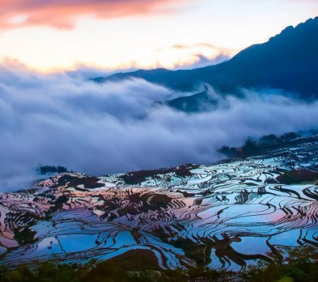
 Hani Rice Terraces
 Kunming
 Lijiang
 Shangri-la
 Dali
Dali
 XishuangBanna
 Honghe
 Kunming
 Lijiang
 Shangri-la
 Yuanyang Rice Terraces
 Nujiang
 XishuangBanna
 Spring City Golf
 Snow Mountain Golf
 Stone Mountain Golf
Nujiang Grand Canyon Hiking Tours Tips around Bingzhongluo
This guide introduces various hiking itineraries around Bingzhongluo in the Nujiang Grand Canyon. The routes range from one-day trips to multi-day adventures and long-distance treks. Detailed itineraries, travel tips, and essential information are provided below.
I. One-Day Trips around Bingzhongluo
Hiking Route 1: Qiuna Tong Golden Route One-Day Tour
Itinerary:
-
Route: Bingzhongluo – Chongding Catholic Church – Jiasheng Village – Shimen Pass – Siji Tong – Chaohong Bridge – Ancient Tea Horse Road – Wulini Dadan – Qiuna Tong
-
Tip:
-
Enter by vehicle and exit on foot.
-
One-way route covers 20 km and takes about 7–8 hours.
-
Along the way, only Qiuna Tong and Nidan offer food and lodging, so it is best to bring your own supplies.
-
Hiking Route 2: Ascend the Sacred Gongdang, Descend the Mysterious Nujiang
Itinerary:
-
Morning:
-
Bingzhongluo – Lisu Ethnic Village – Bingzhongluo Christian Church – Lisu Village – Highway – Tibetan-style White Pagoda – Poultry Farm – Cliff Viewpoint at Nujiang’s First Bend – Return to Bingzhongluo (3.5–4 hours)
-
-
Afternoon:
-
Bingzhongluo – Peach Blossom Island Suspension Bridge – Peach Blossom Island – Kantong Village at Nujiang’s First Bend – Dara Suspension Bridge – Dara Village – Roadside – Viewing Platform at Nujiang’s First Bend – Ridang Village – Bingzhongluo Viewing Platform – Back to Bingzhongluo
-
-
Tip:
-
Total distance is 18 km and requires 7–8 hours.
-
When visiting a Lisu household, drinking is a must to be welcomed out.
-
Bring some dry food to maintain your energy.
-
Hiking Route 3: Gawagapu Snow Mountain Viewing Platform
Itinerary:
-
Route: Bingzhongluo – Gemalo River Gorge – Puhua Temple – Qiukedang – Shimen Peak – Distant View of Picturesque Wuli Village – Gawagapu Viewing Platform – Back to Bingzhongluo
-
Tip:
-
Total distance is 16 km and takes about 7–8 hours.
-
Bring your own dry food as there are no supply points along the way.
-
Hiking Route 4: Watch the Sunrise at Biluo, Enjoy the Gawa Golden Mountain
Itinerary:
-
Route: Bingzhongluo – Chongding Village – Xincun – Xincun Suspension Bridge – Xingta – Watermill – Nujiang Beach (during winter/spring) – Peach Blossom Island – Peach Blossom Island Suspension Bridge – Back to Bingzhongluo
-
Tip:
-
Depart at 5:30 AM; you’ll be hiking in the dark on mountain paths (it’s very cold so bring enough heavy clothing).
-
Bring your own dry food and drinking water.
-
Total distance is 15 km and takes 6–8 hours.
-
Hiking Route 5: Exploring the Mysterious Chala Du Long Village
Itinerary:
-
Route: Bingzhongluo – Shuangla – Xiao Chala – Chala – Jiutong New Village – Jiutong Suspension Bridge – Roadside (by vehicle) – Back to Bingzhongluo
-
Tip:
-
Total of 15 km (excluding the vehicle portion), requiring 6–7 hours.
-
When visiting the Wenmian women’s home, if you wish to take photographs, you must pay a fee – agree on the price in advance.
-
Bring your own dry food.
-
Hiking Route 6: Wuli to Biwang Trek
Itinerary:
-
Route: Bingzhongluo – Chaohong Bridge – Ancient Tea Horse Road – Wuli – Wuli Valley – Biwang – Qiubi – Hengma – Wuli – Chaohong Bridge (by vehicle) – Back to Bingzhongluo
-
Tip:
-
Total distance is 19 km (excluding vehicle segments), taking about 8–9 hours.
-
There are no supply stops along the way, so bring your own dry food.
-
II. Two-Day Trips around Bingzhongluo
Hiking Route 1: Wuli to Biwang Trek (Two-Day Itinerary)
Itinerary:
-
Day 1:
-
Bingzhongluo – Gemalo River Gorge – Puhua Temple – Chongding Catholic Church – Jiasheng Zipline – Shimen Pass – Chaohong Bridge – Ancient Tea Horse Road – Overnight in Wuli
-
-
Day 2:
-
Wuli – Biwang – Hengma – Qiubi – Wuli – Ancient Tea Horse Road – Chaohong Bridge – Return to Bingzhongluo
-
-
Tip:
-
Total distance is 40 km with 8–9 hours of hiking per day.
-
Bring a sleeping bag, an anti-moisture mat, and enough dry food.
-
Hiring a guide is necessary.
-
Hiking Route 2: Wuli to Xingtā Trek
Itinerary:
-
Day 1:
-
Bingzhongluo – Gemalo River Gorge – Puhua Temple – Qiukedang – Shimen Pass – Siji Tong – Chaohong Bridge – Ancient Tea Horse Road – Overnight in Wuli
-
-
Day 2:
-
Wuli – Qiangren – Xingtā – Chongding – Return to Bingzhongluo
-
-
Tip:
-
Total distance is 38 km with daily hiking of 8–9 hours.
-
Bring your own sleeping bag, anti-moisture mat, and journey food.
-
Hiking Route 3: Entering the Tibetan Villages – Dimalo
This itinerary has two alternative options:
Route A:
-
Day 1:
-
Bingzhongluo – Peach Blossom Island Suspension Bridge – Peach Blossom Island – Sinidang – Wangqi – Jiutong – Banganluo – Aluluka – Overnight in Dimalo
-
-
Day 2:
-
Return from Dimalo to Bingzhongluo by vehicle
-
Route B:
-
Day 1:
-
Bingzhongluo (by vehicle) – Shuangla – Shuangla Suspension Bridge – Chala – Longgong – Aluluka – Overnight in Dimalo
-
-
Day 2:
-
Return from Dimalo to Bingzhongluo by vehicle
-
-
Tip:
-
Total distance is over 20 km (vehicle portions are not counted) and requires 6–10 hours.
-
Bring your own dry food.
-
The route involves many forks, so having a guide is highly recommended.
-
III. Long-Distance Hiking
Hiking Route 1: Getting Close to Gawagapu
Gawagapu is the main peak of the Gaoligong Mountains and the foremost among Bingzhongluo’s ten sacred mountains. Standing at 5128 meters, its summit is snow-capped year-round. The modern glacial landforms are well developed, and the ancient glacial scenery is truly spectacular. Five glaciers hang from the mountain from north to south, with the largest covering an area of 2 square kilometers. One glacier’s ice tongue descends to 4000 meters, and just below the northernmost hanging glacier—about 1 km down—is Chugan Lake. Below the glaciers, expansive troughs, snow peaks, meadows, lakes, and primeval forests combine to create an extraordinary landscape.
Itinerary:
-
Day 1:
-
Bingzhongluo – Dongfeng Village – Puhua Temple – Baihe Valley – Diqiandang Small Pasture – Jiagetong Large Pasture (20 km)
-
-
Day 2:
-
Jiagetong Large Pasture – Nianwaluo Pass – Knife-edge Ridge – Chukua Lake (18 km)
-
-
Day 3:
-
Chukua Lake – Niudala Pass – Below Gawagapu Peak – Back to Chukua Lake (10 km)
-
-
Day 4:
-
Chukua Lake – Nianwaluo Lake – Nianwaluo River – Nianwaluo Pasture (15 km)
-
-
Day 5:
-
Nianwaluo Pasture – Siji Tong – Return to Bingzhongluo (25 km)
-
-
Tip:
-
Total distance is 88 km over 5 days with daily hikes of 8–9 hours; the route is quite strenuous.
-
Bring your own food, tent, sleeping bag, and other necessary outdoor gear.
-
It is essential to have a guide and, ideally, hire a porter.
-
Hiking Route 2: Exploring the High-Altitude Lake – Chugan Lake
Chugan Lake is located about 1 km below the rearmost hanging glacier of Gawagapu Snow Mountain. Covering an area of 0.6 square kilometers at an altitude of 3500 meters, the lake was formed by glacial erosion. Its crystal-clear water connects with glacial troughs and meadows and is surrounded by dense primeval forests, offering fresh air and an excellent natural environment.
Itinerary:
-
Route:
-
Bingzhongluo – Siji Tong – Ascend the Mountain – Along the Ridge – Chugan Lake – Return
-
-
Tip:
-
The round-trip takes 4–5 days with full camping equipment and requires you to bring your own dry food.
-
A guide is mandatory; do not venture alone.
-
Additional Note:
There is also Longzhangwang Lake, accessible from Bingzhongluo via Shuangla and Xiao Chala. Legend has it that a Tiger Flight from the Camel Peak Route crashed into this lake. Additionally, there are two other alpine lakes in the area.
