7 Days GolfingTour
 8 Days Group Tour
 8 Days Yunnan Tour
 7 Days Shangri La Hiking
 11 Days Yunnan Tour
 6 Days Yuanyang Terraces
 11 Days Yunnan Tour
 8 Days South Yunnan
 7 Days Tea Tour
 8 Days Muslim Tour
 12 Days Self-Driving
 4 Days Haba Climbing
 Tiger Leaping Gorge
 Stone Forest
 Yunnan-Tibet
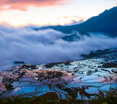
 Hani Rice Terraces
 Kunming
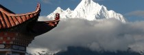
 Lijiang
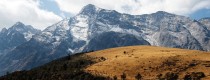
 Shangri-la
 Dali
Dali
 XishuangBanna
 Honghe
 Kunming
 Lijiang
 Shangri-la
 Yuanyang Rice Terraces
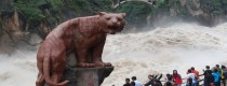
 Nujiang
 XishuangBanna
 Spring City Golf
 Snow Mountain Golf
 Stone Mountain Golf
Pengdang Town of Gongshan County, Nujiang
Chinese Name: 贡山县捧当乡
English Name: Pengdang Town of Gongshan County, Nujiang
Pondong Township is located in the northeast of Gongshan County, Nujiang Lisu Autonomous Prefecture, Yunnan Province, 20 kilometers away from the county town. It is a place with beautiful scenery, rich resources, and rich ethnic customs. Below is a detailed introduction to Pondong Township:
Geographical Location
Pondong Township is located in the middle of the Nujiang Grand Canyon, with high mountains and deep valleys, presenting a canyon landform. Its terrain is narrow in the north and wide in the south, shaped like a gourd. The east and north border Weixi and Deqin counties of Diqing Tibetan Autonomous Prefecture, the south connects with Zitsai Town, and the northwest adjoins Bingzhongluo Town. The township government is located in Pondong, 20 kilometers away from the county town.
Topography
Pondong Township is located on the western slope of Biluo Snow Mountain, with relatively gentle terrain and an average altitude of 1,800 meters. The highest peak is located on the eastern bank of the Nujiang River in Biluo Snow Mountain, with an altitude of 4,263 meters; the lowest point is at the Nujiang River surface in Shandang Village, with an altitude of 1,350 meters.
Climate Conditions
Pondong Township has a subtropical humid climate with significant vertical climate characteristics. The average annual temperature is 14.7°C, the frost-free period is 268 days on average, the average annual sunshine duration is 1,304 hours, and the average annual precipitation is 1,726.5 millimeters.
Population and Ethnic Groups
Pondong Township has a total population of 5,970 people (as of 2017), with the majority being agricultural population. It is home to nine ethnic groups, including Nu, Lisu, Tibetan, Dulong, and Han, with the ethnic minority population accounting for 97.4% of the total population. Among them, the Nu people account for 30.6%, the Lisu people account for 45%, the Tibetans account for 16.6%, and the Dulong people account for 4.2%.
Administrative Divisions
Pondong Township administers four village committees (Shandang, Yonglagga, Dimaruo, and Maxidang), 38 village groups, and 11 township-level stations and offices.
Economic Conditions
Pondong Township has a total of 11,384 mu of cultivated land, with an average of 2.1 mu per capita. By the end of 2003, the total area of crop cultivation was 24,308 mu, the total grain output was 2.42 million kilograms, and the average grain per capita was 438 kilograms. The total rural economic income was 677,900 yuan, with an average per capita net income of 778 yuan. The main crops include corn, rice, and buckwheat.
Specialty Industries
Pondong Township is one of the main areas for animal husbandry in the county, with rich highland pastures and small flatlands along the river valleys, providing good conditions for agricultural and animal husbandry production. In addition, the township has extensive原始 forests of fir and pine, making it a great place for forest adventure tourism.
Culture and Tourism
Pondong Township has rich folk culture, with various ethnic groups living together and forming a unique cultural landscape. Additionally, the township has natural attractions such as the Dimaruo Canyon, making it a great place for tourism.
Historical Evolution
The historical evolution of Pondong Township is quite complex. From the late Qing Dynasty to the Republic of China, and then after the founding of the People’s Republic of China, it has undergone several administrative adjustments. In 1984, the Pondong District was established, and in 1988, the district was converted into a township, named Pondong Township.
Pondong Township, with its unique geographical location, rich natural resources, diverse ethnic cultures, and good ecological environment, has become a place with development potential.