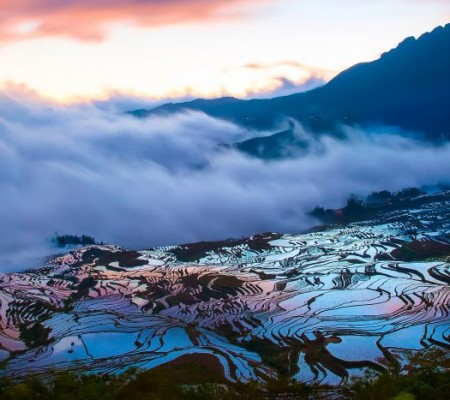
Xianglang Yi Ethnic Town in Mengla County, Xishuangbanna
Chinese Name:勐腊县象明彝族乡
English Name: Xianglang Yi Ethnic Town in Mengla County, XishuangBanna
Baishijia Festival of Yi Ethnic Minority is held in Xianglang Yi Ethnic Town in Mengla County, XishuangBanna every year.
Chinese Name: 勐腊县象明彝族乡
English Name: Xianglang Yi Ethnic Town in Mengla County, Xishuangbanna
Overview: Xianglang Yi Ethnic Town, also known as Xiangming Yi Ethnic Township, is located in Mengla County, Xishuangbanna. The Baishijia Festival of the Yi Ethnic Minority is held annually in this town.
Geography and Location:
- Location: Xianglang Yi Ethnic Town is situated in the northern part of Mengla County, at approximately 21.59°N to 22.19°N latitude and 101.08°E to 101.26°E longitude. It borders Yiwang Township to the east, connects with Menglun Town to the south, adjoins Jinghong City’s Mengyang Town and Jinuo Township to the west, and neighbors Mengwang Township in Jinghong City to the north. It is the only Yi ethnic township in Xishuangbanna, located 160 kilometers from Mengla County and 170 kilometers from the provincial capital.
History:
- Historical Significance: Xianglang Yi Ethnic Town is one of the key areas for the production of ancient Pu’er tea. Historically, it was part of the territory of the Yi Bang Tusi (chieftain) and was governed by Cheli (present-day Jinghong). In 1958, Xiangming District was established with its government located in Yibang Street. Over time, the area has undergone various administrative changes, including becoming part of the Xishuangbanna Prefecture in 1953, then reestablished as Xiangming District in 1958, and later renamed as Xiangming Township in 1988.
Culture and Festivals:
- Baishijia Festival: The annual Baishijia Festival is a significant cultural event for the Yi ethnic minority in Xianglang Yi Ethnic Town. It celebrates traditional Yi culture and heritage.
Geography and Environment:
- Terrain and Climate: The town has a diverse topography with a high elevation in the east and lower elevations in the south. The highest point is at 1,950 meters (Shanshen Temple) and the lowest is at 565 meters (Manpei Ferry). The average altitude is 1,200 meters. The climate is characterized by an average annual temperature between 17°C and 19°C and annual rainfall ranging from 1,500 to 1,900 millimeters.
Economy and Agriculture:
- Main Industries: The primary industries include livestock, tea cultivation, rubber production, and cardamom. Xianglang Yi Ethnic Town is renowned as the birthplace of Pu’er tea, with four of the six famous tea mountains (Yibang, Manzhuan, Gedeng, and Mangzhai) located within the township.
Resources and Environment:
- Forests and Agriculture: The township has a forest area of 69,252.3 hectares, with main tree species including water red flower trees, mountain osmanthus trees, and southwest birch. The forest resources are well-protected, especially in the Yibang village committee. The total arable land area is 52,673 acres, including 7,721 acres of paddy fields and 44,952 acres of dry land. Main agricultural products are tea, rubber, cardamom, and bamboo shoots. The annual grain production is 5.87 million kilograms, with a per capita grain availability of 639 kilograms. Tea production is 146 tons, mainly distributed in Yibang, Anle, Manlin, and Manzhuang village committees. Rubber production is 266.8 tons, primarily in Manlin village committee. Cardamom production is 5.16 tons, and bamboo shoots production is 6.12 tons.
Rivers:
- Major Rivers:
- Xiangming River: Flows through Yibang, Manzhuang, and Manlin village committees before joining the Luosuo River. It is 46 kilometers long, with a catchment area of 339 square kilometers, an annual runoff depth of 725 millimeters, and an annual runoff volume of 246 million cubic meters.
- Mozhe River: Flows through Mozhe River village group. It is 64.9 kilometers long, with a catchment area of 554 square kilometers, an annual runoff depth of 924 millimeters, and an annual runoff volume of 512 million cubic meters.
- Longgu River: Flows through the Longgu village committee in Xianglang Township. It is 42.6 kilometers long, with a catchment area of 111 square kilometers, an annual runoff depth of 683 millimeters, and an annual runoff volume of 76 million cubic meters.
Travel Tips:
- Best Time to Visit: The best time to visit is during the dry season when the weather is more favorable for exploring and participating in local festivals.
- How to Get There: Accessible by road from Mengla County and Jinghong City. Travel by car is the most convenient option.
Accommodation:
- Nearby Options: Look for accommodations in Mengla County or Jinghong City for comfortable lodging options.
Tour Maps and Visiting Routes:
- Maps: Available from local tourist information centers and online for detailed exploration and navigation.
Conclusion: Xianglang Yi Ethnic Town offers a unique blend of natural beauty, cultural heritage, and traditional Yi practices, making it a fascinating destination in Xishuangbanna.

 7 Days GolfingTour
 8 Days Group Tour
 8 Days Yunnan Tour
 7 Days Shangri La Hiking
 11 Days Yunnan Tour
 6 Days Yuanyang Terraces
 11 Days Yunnan Tour
 8 Days South Yunnan
 7 Days Tea Tour
 8 Days Muslim Tour
 12 Days Self-Driving
 4 Days Haba Climbing
 Tiger Leaping Gorge
 Stone Forest
 Yunnan-Tibet
 Hani Rice Terraces
 Kunming
 Lijiang
 Shangri-la
 Dali
Dali
 XishuangBanna
 Honghe
 Kunming
 Lijiang
 Shangri-la
 Yuanyang Rice Terraces
 Nujiang
 XishuangBanna
 Spring City Golf
 Snow Mountain Golf
 Stone Mountain Golf


